National Register of Historic Places listings in Bryan County, Oklahoma facts for kids
Hey there! Did you know that some places are so special and important that they get listed on a national register? This list is all about the cool historic spots in Bryan County, Oklahoma, that are part of the National Register of Historic Places.
The National Register of Historic Places is like a special club for buildings, sites, and objects that are important to American history, architecture, archaeology, engineering, or culture. When a place is on this list, it means it's recognized for its value and efforts are made to protect it.
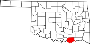
In Bryan County, Oklahoma, there are 16 amazing places on this list. One of them is even a National Historic Landmark, which is an even higher level of historical importance! You can see where these places are on a map if you look at their coordinates.
Historic Places in Bryan County
| Name on the Register | Image | Date listed | Location | City or town | Description | |
|---|---|---|---|---|---|---|
| 1 | Armstrong Academy Site |
(#72001056) |
3 miles northeast of Bokchito 34°03′01″N 96°11′59″W / 34.050278°N 96.199722°W |
Bokchito | This site was once home to the Armstrong Academy. It was an important school for boys of the Choctaw Nation during the 1800s. | |
| 2 | Bloomfield Academy Site |
(#72001055) |
South of Achille off State Highway 78 33°47′58″N 96°23′01″W / 33.799444°N 96.383611°W |
Achille | The Bloomfield Academy was a significant school for girls of the Chickasaw Nation. It played a big role in educating young women in the area. | |
| 3 | Bryan County Courthouse |
(#84002974) |
4th Ave. and Evergreen St. 33°59′34″N 96°22′52″W / 33.992778°N 96.381111°W |
Durant | This is the main building for Bryan County's government. It's where important legal and administrative work happens for the county. | |
| 4 | Caddo Community Building |
(#88001376) |
E. Buffalo St. 34°07′32″N 96°15′43″W / 34.125556°N 96.261944°W |
Caddo | The Caddo Community Building has been a central gathering spot for the town of Caddo for many years. It's where people come together for events and meetings. | |
| 5 | Carriage Point |
(#72001058) |
4 miles west of Durant 33°59′07″N 96°27′16″W / 33.985278°N 96.454444°W |
Durant | Carriage Point was an important stop along old travel routes. It served as a station for travelers and their carriages in the past. | |
| 6 | Colbert's Ferry Site |
(#72001057) |
3 miles southeast of Colbert 33°49′13″N 96°31′20″W / 33.820278°N 96.522222°W |
Colbert | This site marks where Colbert's Ferry once operated. Ferries were boats used to carry people and goods across rivers before bridges were common. | |
| 7 | Durant Downtown Historic District |
(#07000517) |
Roughly bounded by 4th Ave., Lost St., Evergreen St., and 1st Ave. 33°59′29″N 96°22′43″W / 33.9913°N 96.3787°W |
Durant | This district includes many historic buildings in the heart of Durant. It shows what the town looked like in earlier times. | |
| 8 | Fort McCulloch |
(#71000659) |
2 miles southwest of Kenefic 34°07′52″N 96°23′42″W / 34.131111°N 96.395°W |
Kenefic | Fort McCulloch was a military fort built during the American Civil War. It played a role in the conflict in this region. | |
| 9 | Fort Washita |
(#66000626) |
Southwest of Nida on State Highway 199 34°06′13″N 96°32′54″W / 34.103611°N 96.548333°W |
Nida | Fort Washita is a very important historic site. It was a frontier military post built in 1842 to protect the Choctaw Nation and Chickasaw Nation from raids. | |
| 10 | Robert E. Lee School |
(#88001374) |
9th and Louisiana Sts. 33°59′22″N 96°23′09″W / 33.989444°N 96.385833°W |
Durant | This building once served as the Robert E. Lee School. It was an important place for education in the Durant community. | |
| 11 | Nail's Station |
(#72001059) |
2 miles southwest of Kenefic 34°07′52″N 96°23′26″W / 34.1312°N 96.3905°W |
Kenefic | Nail's Station was another significant stop along old travel routes, similar to Carriage Point. These stations were vital for travelers in the past. | |
| 12 | Oklahoma Presbyterian College |
(#76001556) |
601 N. 16th St. 34°00′00″N 96°23′35″W / 34.0°N 96.393056°W |
Durant | The Oklahoma Presbyterian College was an important educational institution in Durant. It provided higher education for many years. | |
| 13 | Roberta School Campus |
(#88001377) |
Off State Highway 70 33°55′41″N 96°18′13″W / 33.928056°N 96.303611°W |
Durant | The Roberta School Campus represents a historic place of learning for the community of Roberta, near Durant. | |
| 14 | State Highway 78 Bridge at the Red River |
(#96001517) |
State Highway 78, across the Red River at the Oklahoma-Texas state line 33°45′10″N 96°11′45″W / 33.752778°N 96.195833°W |
Kemp | This bridge carries State Highway 78 over the Red River. It connects Oklahoma with Texas and is an important part of the region's transportation history. | |
| 15 | Robert Lee Williams Public Library |
(#88001375) |
4th and Beech Sts. 33°59′36″N 96°22′44″W / 33.993333°N 96.378889°W |
Durant | The Robert Lee Williams Public Library has served the Durant community for many years. It's a place for learning and reading for everyone. | |
| 16 | J. L. Wilson Building |
(#82003668) |
202 W. Evergreen St. 33°59′26″N 96°22′48″W / 33.990556°N 96.38°W |
Durant | The J. L. Wilson Building is a historic structure in Durant. It shows the architectural style of its time and has been part of the city's growth. |


