National Register of Historic Places listings in Pittsburg County, Oklahoma facts for kids
Have you ever wondered about the oldest and most special buildings or places in your town? In Pittsburg County, Oklahoma, there are many such spots! These places are so important that they are listed on something called the National Register of Historic Places.
The National Register of Historic Places is like a special list kept by the United States government. It helps protect buildings, sites, and objects that are important to history. When a place is on this list, it means it tells a unique story about the past. It could be about how people lived, worked, or what big events happened there.
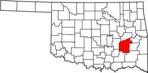
In Pittsburg County, Oklahoma, there are 30 different places on this list. These include old hotels, schools, churches, and even a courthouse! There was once another place listed, but it was removed from the list later on. Let's explore some of these amazing historic sites!
What Makes a Place Historic?
A place becomes "historic" when it has special meaning from the past. This could be because of its age, its unique design, or important events that happened there. For example, a building might be historic if a famous person lived there. Or, it might be historic if it shows how people built things a long time ago.
Why Do We Protect Historic Places?
Protecting historic places is very important. It helps us remember our past and learn from it. These places are like giant history books that we can walk through! They also help keep our communities unique and interesting. Imagine if all old buildings were torn down – our towns would look very different and lose their special charm.
Historic Places in Pittsburg County
Pittsburg County has a rich history, and its historic places show this. From grand old hotels to simple cabins, each site has a story.
Historic Buildings in McAlester
McAlester, Oklahoma is the biggest city in Pittsburg County. Many historic places are found right here!
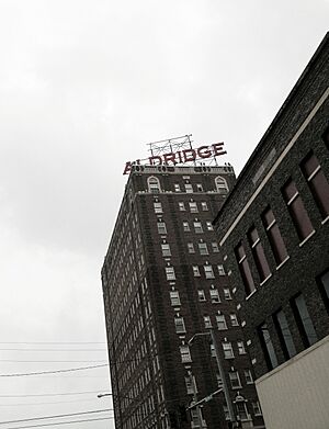
Aldridge Hotel
The Aldridge Hotel is a beautiful old building. It was listed on the National Register in 1995. Hotels like this were once very busy places. They welcomed travelers and important guests from all over.
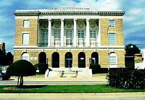
Federal Building and US Courthouse
The Federal Building and US Courthouse is another important site. It was built a long time ago and is where important government work happens. It was added to the list in 2000.
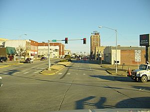
McAlester Downtown Historic District
Sometimes, a whole area can be historic! The McAlester Downtown Historic District is an example. This area includes many old buildings that together tell the story of downtown McAlester. It was listed in 2015.
Other Notable Buildings
- Busby Office Building and Busby Theatre: These buildings show what business and entertainment were like in the past.
- First Presbyterian Church: Old churches often have beautiful architecture and long histories.
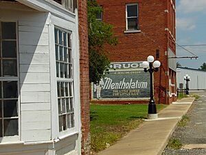
- Hokey's Drugstore: This old drugstore in Krebs, Oklahoma reminds us of how people used to shop.
- McAlester Scottish Rite Temple: This building is known for its grand design.
- OKLA Theater: An old movie theater that once entertained many people.
- Warden's House: This was the home of the warden for the nearby prison.
Historic Schools and Community Places
Schools are often important historic places because they show how education has changed.
Cole Chapel School
The Cole Chapel School near Hartshorne, Oklahoma is an example of an old school building. It was listed in 1988.
New State School
Another school, the New State School, also near Hartshorne, is on the list. These schools helped educate children in the early days of Oklahoma.
Pittsburg School and Gymnasium
The Pittsburg School and Gymnasium in Pittsburg, Oklahoma is another historic school site. It shows how communities built places for both learning and sports.
Tipton Ridge School
The Tipton Ridge School near Blocker, Oklahoma is also recognized for its historical value.
L'Ouverture Gymnasium
The L'Ouverture Gymnasium in McAlester is a special place. It was an important community center for African Americans during a time when segregation was common. It was listed in 2006.
Other Unique Historic Sites
Pittsburg County has a variety of other interesting historic places.
Blackburn's Station Site
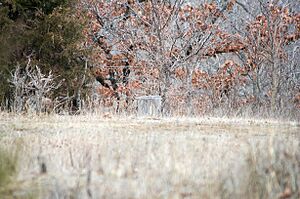
The Blackburn's Station Site is not a building, but a location. It was an important stop along an old trail. It was listed in 1973.
Canadian Jail and Livery Stable
In Canadian, Oklahoma, you can find the Canadian Jail and Livery Stable. This shows how law and order, and transportation, worked in the past.
Choate Cabin
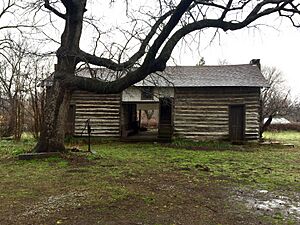
The Choate Cabin in Indianola is a simple log cabin. It gives us a peek into the lives of early settlers. It was listed in 1979.
Mass Grave of the Mexican Miners
This site at Mount Calvary Cemetery in McAlester is a Mass Grave of the Mexican Miners. It remembers a sad event in history and honors those who lost their lives. It was listed in 1980.
Perryville
Perryville is a historic site southwest of McAlester. It was once an important settlement. It was listed in 1972.
Rock Creek Bridge
Bridges can also be historic! The Rock Creek Bridge near Blanco, Oklahoma is an old bridge that is still used today. It was listed in 2008.
St. Joseph's Catholic Church
The St. Joseph's Catholic Church in Krebs, Oklahoma is another historic church. It has been a place of worship for many years.
Former Listings
Sometimes, a place might be removed from the National Register. This can happen if the building is changed too much or is torn down.
Southern Ice and Cold Storage Company
The Southern Ice and Cold Storage Company in Pittsburg was once on the list. It was added in 1979 but removed in 2014.
Images for kids
 | James Van Der Zee |
 | Alma Thomas |
 | Ellis Wilson |
 | Margaret Taylor-Burroughs |


