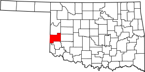
National Register of Historic Places listings in Beckham County, Oklahoma facts for kids
Welcome to Beckham County, Oklahoma! This page is all about the cool, old places in the county that are listed on the National Register of Historic Places. Think of it like a special list of buildings, sites, and areas that are super important to history. They are worth protecting so everyone can learn from them.
In Beckham County, there are 15 of these special places. They include old courthouses, hotels, homes, and even a historic park. These places help us understand what life was like a long time ago in Oklahoma. You can even see where some of these historic spots are on a map!
Exploring Beckham County's Historic Gems
Beckham County has many interesting places that tell stories from the past. These sites are officially recognized for their historical importance. Let's take a look at some of these amazing spots!
Historic Buildings and Homes
Many buildings in Beckham County have been around for a long time and have cool stories.
Beckham County Courthouse
The Beckham County Courthouse is in Sayre. It's a really important building where local government decisions are made. It was added to the National Register in 1984. Courthouses often have interesting architecture and are central to a town's history.
Casa Grande Hotel
In Elk City, you can find the Casa Grande Hotel. This old hotel was listed in 1995. Hotels like this were once busy places where travelers would stay. Imagine all the different people who might have passed through its doors!
J. W. Danner House
The J. W. Danner House is another historic home in Sayre. It was built a long time ago and was added to the list in 2002. Old houses often show us how people lived and what styles were popular in the past.
Storm House
Also in Elk City is the Storm House. This house was recognized in 1983. It's another example of the historic homes that are preserved in the county.
Old Businesses and Travel Stops
Some historic places were once busy centers for business or travel.
First National Bank (Erick, Oklahoma)
The First National Bank in Erick was listed in 1979. Banks are important buildings because they show how towns grew and how people managed their money. This one tells a story of Erick's early days.
Hedlund Motor Company Building
The Hedlund Motor Company Building in Elk City was added to the list in 1983. This building was likely a place where cars were sold or repaired. It reminds us of how transportation changed over time.
Magnolia Service Station
Along the famous U.S. Route 66 in Texola, you'll find the Magnolia Service Station. This old gas station was listed in 1995. Route 66 was a very important road for travel across America, and service stations like this were vital stops for drivers.
Sayre Champlin Service Station
Another historic gas station is the Sayre Champlin Service Station in Sayre. It was added to the list in 2004. These old service stations have a unique look and remind us of a time when road trips were becoming popular.
West Winds Motel
The West Winds Motel in Erick was listed in 2004. Motels along old highways like Route 66 were common places for families and travelers to rest during their journeys.
Community and Transportation Hubs
These places were important for community life or getting around.
Sayre City Park
The Sayre City Park was recognized in 2004. Parks are important for communities, offering places for people to relax, play, and gather. This park has been a special spot for Sayre residents for many years.
Sayre Downtown Historic District
The Sayre Downtown Historic District includes a whole area of historic buildings around Main and 4th Streets in Sayre. It was listed in 2002. Historic districts are like outdoor museums, showing how a town's center looked and functioned in the past.
Sayre Rock Island Depot
The Sayre Rock Island Depot is an old train station in Sayre. It was added to the list in 2000. Train depots were once very busy places, connecting towns and people across the country. They were vital for travel and trade.
Whited Grist Mill
The Whited Grist Mill in Elk City is a very old mill that was listed in 1976. It's now part of the Old Town Museum. Grist mills were places where grain was ground into flour, which was a very important process for early communities.
Other Important Sites
Some historic sites are not buildings but important archaeological or homestead areas.
Edwards Archeological Site
The Edwards Archeological Site near Carter is a very old site that was listed in 1973. Archaeological sites are places where scientists study the remains of past human activity, like tools or old settlements. The exact location is kept secret to protect it.
Vannerson Homestead
The Vannerson Homestead is near Erick and was listed in 2015. A homestead is a piece of land where a family settled and built their home and farm. These sites tell us about the pioneers who helped settle Oklahoma. Its exact location is also kept private.
Images for kids


