National Register of Historic Places listings in Lincoln County, Oklahoma facts for kids
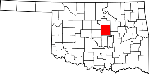
This page is all about the special old buildings and places in Lincoln County, Oklahoma. These places are so important that they've been added to a list called the National Register of Historic Places. Think of it like a hall of fame for historic sites across the United States.
When a building or place is on this list, it means it's recognized for its history, amazing design, or how it helped shape the past. In Lincoln County, there are 46 different places on this list. Some of them are old houses, like the Conklin and Johnson Houses in Chandler, which are known for their beautiful Colonial Revival style (a classic American design). One place used to be on the list but was later removed.
Historic Places in Lincoln County
This section lists all the amazing places in Lincoln County that are currently on the National Register of Historic Places. Each one has a unique story and helps us remember the past.
| Name on the Register | Image | Date listed | Location | City or town | Description | |
|---|---|---|---|---|---|---|
| 1 | Bon Ton House |
(#86002350) |
404 N. 4th St. 35°45′03″N 96°39′27″W / 35.750833°N 96.6575°W |
Stroud | ||
| 2 | Boston Store |
(#84003107) |
917 Manvel Ave. 35°42′03″N 96°52′31″W / 35.700833°N 96.875278°W |
Chandler | ||
| 3 | Captain Creek Bridge |
(#04000134) |
West of the junction of Hickory St. and State Highway 66B 35°41′35″N 97°04′16″W / 35.693056°N 97.071111°W |
Wellston | ||
| 4 | Joseph Carpenter House |
(#86002346) |
204 W. 6th St. 35°45′06″N 96°39′19″W / 35.751667°N 96.655278°W |
Stroud | ||
| 5 | Chandler Armory |
(#91000276) |
Junction of Mickey Clarkson Ave. and 1st St. 35°42′34″N 96°52′36″W / 35.709444°N 96.876667°W |
Chandler | ||
| 6 | Chandler Baseball Camp |
(#11000339) |
2000 W. Park Rd. 35°42′22″N 96°54′06″W / 35.706111°N 96.901667°W |
Chandler | ||
| 7 | Chandler Bookstore |
(#84003110) |
713 Manvel Ave. 35°42′12″N 96°52′31″W / 35.703333°N 96.875278°W |
Chandler | ||
| 8 | Chandler High School |
(#96000372) |
515 Steele Ave. 35°42′18″N 96°52′55″W / 35.705°N 96.881944°W |
Chandler | ||
| 9 | Clapp-Cunningham Building |
(#84003112) |
1021 Manvel Ave. 35°41′58″N 96°52′31″W / 35.699444°N 96.875278°W |
Chandler | ||
| 10 | Conklin House |
(#84003116) |
206 W. 8th St. 35°42′09″N 96°52′56″W / 35.7025°N 96.882222°W |
Chandler | This house is one of three special Colonial Revival style homes in Chandler. They were built before Oklahoma became a state! | |
| 11 | Crane Motor Company Building |
(#95000036) |
722 Manvel Ave. 35°42′10″N 96°52′49″W / 35.702778°N 96.880278°W |
Chandler | ||
| 12 | Crescent School |
(#96000373) |
2.5 miles east and 0.25 miles north of where U.S. Route 62 and State Highway 18 meet 35°30′23″N 96°51′01″W / 35.5064°N 96.8503°W |
Meeker area | ||
| 13 | Davenport Broadway Avenue Brick Street |
(#04000518) |
1-600 Broadway St. 35°42′09″N 96°45′53″W / 35.7025°N 96.764722°W |
Davenport | ||
| 14 | Fairview School |
(#97001149) |
2.25 miles north-northwest of where U.S. Route 62 and State Highway 18 meet 35°32′11″N 96°54′09″W / 35.5364°N 96.9026°W |
Meeker area | ||
| 15 | First Presbyterian Church of Chandler |
(#84003118) |
8th and Blaine Sts. 35°42′10″N 96°52′58″W / 35.702778°N 96.882778°W |
Chandler | ||
| 16 | Flynt Building |
(#07000516) |
720 Manvel Ave. 35°42′10″N 96°52′48″W / 35.702778°N 96.88°W |
Chandler | ||
| 17 | Graham Hotel |
(#79001998) |
Main St. and 2nd Ave. 35°44′57″N 96°39′16″W / 35.749167°N 96.654444°W |
Stroud | ||
| 18 | Hadley House |
(#84000457) |
622 N. 4th Ave. 35°45′10″N 96°39′27″W / 35.752778°N 96.6575°W |
Stroud | ||
| 19 | Walter Hadley House |
(#86002308) |
424 W. 7th St. 35°45′10″N 96°39′30″W / 35.752778°N 96.658333°W |
Stroud | ||
| 20 | Hotel Lincoln |
(#95000037) |
323 Main St. 35°44′57″N 96°39′26″W / 35.749167°N 96.657222°W |
Stroud | ||
| 21 | George Hughes House |
(#86002370) |
308 W. 5th St. 35°45′03″N 96°39′23″W / 35.750833°N 96.656389°W |
Stroud | ||
| 22 | Johnson House |
(#84003121) |
503 Marvel Ave. 35°42′20″N 96°52′51″W / 35.705556°N 96.880833°W |
Chandler | This house, along with the Conklin House, is another special Colonial Revival style home in Chandler built before Oklahoma became a state. | |
| 23 | Moses Keokuk House |
(#73001563) |
6 miles south of Stroud Coordinates missing |
Stroud | ||
| 24 | Mascho Building and Public Privy |
(#84003127) |
717-719 Manvel Ave. 35°42′11″N 96°52′31″W / 35.703056°N 96.875278°W |
Chandler | ||
| 25 | Meeker Town Hall |
(#96000374) |
115 N. Fowler St. 35°30′14″N 96°54′09″W / 35.5038°N 96.9025°W |
Meeker | ||
| 26 | William Alfred Mensch Building |
(#00001576) |
218 W. Main St. 35°44′55″N 96°39′20″W / 35.748611°N 96.655556°W |
Stroud | ||
| 27 | Midlothian School |
(#96000375) |
2.25 miles west and 4 miles south of where State Highway 18 and the old U.S. Route 66 meet 35°38′15″N 96°55′35″W / 35.6375°N 96.9263°W |
Midlothian | ||
| 28 | National Guard Statistical Building |
(#99000672) |
Park Rd., 1 block west of 6th St. 35°42′12″N 96°53′11″W / 35.703333°N 96.886389°W |
Chandler | ||
| 29 | Oleson-Crane Building |
(#84003129) |
721 Manvel Ave. 35°42′10″N 96°52′31″W / 35.702778°N 96.875278°W |
Chandler | ||
| 30 | Ozark Trails Section of Route 66 |
(#03001235) |
Where N3540 Rd. and E0890 Rd. meet, west to where E0890 Rd. and the St. Louis – San Francisco railroad tracks meet. 35°43′26″N 96°42′33″W / 35.723889°N 96.709167°W |
Stroud | ||
| 31 | Phillips 66 Station No. 1423 |
(#11000640) |
701 S. Manvel 35°42′12″N 96°52′52″W / 35.703333°N 96.881111°W |
Chandler | This old gas station is part of a special group of places along U.S. Route 66 that are recognized for their history. | |
| 32 | Prague City Hall and Jail |
(#98000732) |
1116 Jim Thorpe Boulevard 35°29′17″N 96°41′06″W / 35.488056°N 96.685°W |
Prague | ||
| 33 | Rock Café |
(#01000661) |
114 W. Main St. 35°44′55″N 96°39′15″W / 35.748611°N 96.654167°W |
Stroud | ||
| 34 | St. Cloud Hotel |
(#84003131) |
1216 Manvel Ave. 35°41′53″N 96°52′32″W / 35.698056°N 96.875556°W |
Chandler | ||
| 35 | St. Paul Baptist Church and Cemetery |
(#02000973) |
4.25 miles north and 1.5 miles west of where U.S. Route 62 and State Highway 18 meet 35°33′53″N 96°54′37″W / 35.5647°N 96.9103°W |
Meeker area | ||
| 36 | St. Stephen's Episcopal Church |
(#00000655) |
812 Blaine Ave. 35°42′08″N 96°52′57″W / 35.702222°N 96.8825°W |
Chandler | ||
| 37 | Seaba's Filling Station |
(#94001609) |
8 miles west of Chandler on the old U.S. Route 66 35°41′11″N 96°59′59″W / 35.686389°N 96.999722°W |
Chandler | ||
| 38 | Southwestern Bell Telephone Building |
(#86001093) |
301 W. 7th St. 35°45′12″N 96°39′22″W / 35.753333°N 96.656111°W |
Stroud | ||
| 39 | Spring Dell School |
(#96000376) |
5 miles south and 0.5 miles west of where State Highway 18 and the old U.S. Route 66 meet 35°37′32″N 96°53′32″W / 35.6256°N 96.8922°W |
Meeker area | ||
| 40 | Old Stroud School |
(#97001150) |
1 mile east of where Interstate 44 and State Highway 99 meet 35°45′13″N 96°40′51″W / 35.753611°N 96.680833°W |
Stroud | ||
| 41 | Stroud Trading Company Building |
(#79001999) |
Main St. and 2nd Ave. 35°44′57″N 96°39′18″W / 35.749167°N 96.655°W |
Stroud | ||
| 42 | James W. Stroud House |
(#84003134) |
110 E. 2nd St. 35°44′52″N 96°39′11″W / 35.747778°N 96.653056°W |
Stroud | ||
| 43 | Marshal William M. Tilghman Homestead |
(#76001568) |
2 miles northwest of Chandler off the old U.S. Route 66 35°43′47″N 96°54′42″W / 35.729722°N 96.911667°W |
Chandler | ||
| 44 | Warwick School |
(#96000377) |
0.75 miles east and 0.25 miles north of where U.S. Route 177 and the old U.S. Route 66 meet 35°41′09″N 97°00′17″W / 35.685833°N 97.004722°W |
Meeker | ||
| 45 | Wolcott Building |
(#84003136) |
725 Manvel Ave. 35°42′09″N 96°52′31″W / 35.7025°N 96.875278°W |
Chandler | ||
| 46 | ZCBJ Lodge No. 46 |
(#84003138) |
S. Barta Ave. 35°28′39″N 96°40′59″W / 35.4775°N 96.683056°W |
Prague |
Former Listing
Sometimes, a historic place might be removed from the list. This usually happens if the building is torn down or changed so much that it no longer has its original historic look.
| Name on the Register | Image | Date listed | Date removed | Location | City or town | Summary | |
|---|---|---|---|---|---|---|---|
| 1 | Bank of Agra |
(#90000122) |
|
400 Grant Avenue |
Agra | This building was taken off the list because it was torn down in 1999. |


