Shanty Run facts for kids
Quick facts for kids Shanty Run |
|
|---|---|

Shanty Run
|
|
| Physical characteristics | |
| Main source | Davidson Township, Sullivan County, Pennsylvania 2,380 to 2,400 feet (730 to 730 m) |
| River mouth | Quinn Run in Davidson Township, Sullivan County, Pennsylvania 1,627 ft (496 m) |
| Length | 1.4 mi (2.3 km) |
| Basin features | |
| Progression | Quinn Run → Heberly Run → East Branch Fishing Creek → Fishing Creek (North Branch Susquehanna River) → Susquehanna River → Chesapeake Bay |
| Basin size | 0.67 sq mi (1.7 km2) |
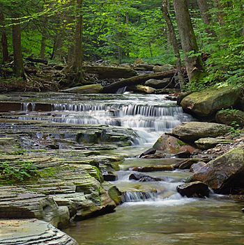
Shanty Run is a small stream located in Sullivan County, Pennsylvania. It flows for about 1.4 miles (2.3 km) through Davidson Township. Shanty Run is a branch, or tributary, of Quinn Run.
The area of land that drains into Shanty Run, called its watershed, covers about 0.67 square miles (1.7 km2). The water in Shanty Run is naturally acidic. Because of this, the Pennsylvania Department of Environmental Protection considers it to be "impaired" by air pollution.
Contents
Where Does Shanty Run Flow?
Shanty Run starts in Davidson Township. It first flows east for a short distance. Then, it turns south and enters a steep valley. After flowing through this valley, the stream meets Quinn Run.
Shanty Run joins Quinn Run about 0.48 miles (0.77 km) before Quinn Run reaches its own end.
Small Streams Joining Shanty Run
Shanty Run has one unnamed tributary. A tributary is a smaller stream that flows into a larger one. This unnamed stream is known as Unt 28004.
What's the Water Like in Shanty Run?
On an average day, about 472 gallons of water flow through Shanty Run every minute. The water's pH is around 5.76. pH is a measure of how acidic or basic something is. A pH of 7 is neutral, lower numbers are acidic, and higher numbers are basic. Shanty Run's pH can change a lot, from very acidic (less than 5) to almost neutral (nearly 7).
Shanty Run sometimes becomes very acidic, especially after heavy rain or snowmelt. This is called episodic acidification. The water quality is considered "fair" on average days. However, when there's a lot of water flowing, it becomes "very poor."
To help the stream, it needs more alkalinity. Alkalinity helps to balance out the acid. Experts suggest adding materials like limestone to the forest floor or roads near the stream. This would help make the water less acidic.
About 1.69 miles (2.72 km) of Shanty Run is considered impaired because of its pH levels, which are affected by air pollution. Also, 0.30 miles (0.48 km) of its unnamed tributary has the same problem.
The Land Around Shanty Run
The land where Shanty Run begins is high up, between 2,380 feet (730 m) and 2,400 feet (730 m) above sea level. Where it joins Quinn Run, the elevation is about 1,627 feet (496 m).
Rocks and Soil
The lower parts of Shanty Run flow over a type of rock called the Huntley Mountain Formation. The upper parts of the stream flow over Burgoon Sandstone. You can see some of these rocks sticking out of the ground near the stream.
The soil around Shanty Run is also very important. In the lower areas, the stream flows over Deep-Wellsboro-Oquaga soil. In the upper areas, it flows over Oquaga and Norris soils. All of these soils in the watershed are strongly acidic.
What is Shanty Run's Watershed?
The watershed of Shanty Run is the entire area of land where all the rain and snowmelt eventually drain into Shanty Run. This area is about 0.67 square miles (1.7 km2). There are about 1.8 miles (2.9 km) of streams, including Shanty Run and its tributary, within this watershed.
The entire watershed is located inside Pennsylvania State Game Lands. This means it's a protected area managed for wildlife. Some parts of Shanty Run can be reached by road.
Helping Shanty Run Get Healthy
Efforts are being made to restore Shanty Run. This is part of a bigger plan called the East Branch Fishing Creek Restoration Plan. This second phase of the plan, which also includes Quinn Run, is expected to cost around $300,000.
The Pennsylvania Department of Environmental Protection first listed Shanty Run and its unnamed tributary as "impaired" in 2002. This means their water quality was not good enough. By 2015, there was a plan in place to set a total maximum daily load (TMDL). A TMDL is like a pollution budget, setting the maximum amount of a pollutant a water body can receive and still meet water quality standards.
 | James Van Der Zee |
 | Alma Thomas |
 | Ellis Wilson |
 | Margaret Taylor-Burroughs |

