Shepherd Mountain facts for kids
Quick facts for kids Shepherd Mountain |
|
|---|---|
| Highest point | |
| Elevation | 1,598 ft (487 m) |
| Geography | |
| Location | Iron County, Missouri, U.S. |
| Parent range | Saint Francois Mountains |
| Topo map | USGS Ironton |
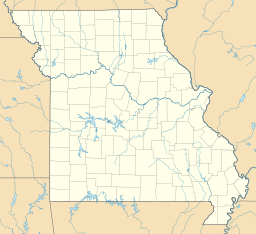
Shepherd Mountain is a mountain peak located in Iron County, in the state of Missouri, United States. This mountain stands just west of the town of Ironton and Stouts Creek. It is part of the beautiful Arcadia Valley area.
Contents
What is Shepherd Mountain?
Shepherd Mountain is a notable peak in the Saint Francois Mountains range. It reaches an elevation of 1,598 feet (about 487 meters) above sea level. This makes it one of the interesting natural features in the region.
How Did Shepherd Mountain Get Its Name?
The mountain was named after a person named Forrest Shepherd. He was a geologist, which means he was a scientist who studies the Earth's rocks and how the planet was formed. It's common for mountains and other natural places to be named after people who explored them or studied them.
What Happened at Shepherd Mountain?
Shepherd Mountain was an important location during a historical event called the Battle of Fort Davidson. This battle took place during the American Civil War. The mountain was a key spot for military actions during this time. Soldiers used the terrain around the mountain as part of their strategies.
Exploring the Area Around Shepherd Mountain
The area around Shepherd Mountain is known for its natural beauty. It is part of the Ozarks region, which has rolling hills, forests, and many streams. People who visit this area can enjoy outdoor activities.
What Can You Do Near Shepherd Mountain?
The region offers opportunities for hiking and exploring nature. The nearby town of Ironton serves as a gateway to these outdoor adventures. Visitors can learn about the local history and enjoy the scenic views.
 | Misty Copeland |
 | Raven Wilkinson |
 | Debra Austin |
 | Aesha Ash |


