Stouts Creek facts for kids
Quick facts for kids Stouts Creek |
|
|---|---|

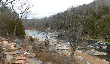
Stouts Creek east of Arcadia, Missouri
|
|
| Country | United States |
| State | Missouri |
| Region | Iron County and Madison County |
| Physical characteristics | |
| Main source | Iron County, Missouri Approximately 410 m (1,350 ft) 37°34′41″N 90°44′05″W / 37.57806°N 90.73472°W |
| River mouth | St. Francis River Madison County, Missouri 208 m (682 ft) 37°35′31″N 90°29′54″W / 37.59194°N 90.49833°W |
Stouts Creek is a small stream located in the state of Missouri, United States. It flows through two counties: Iron County and Madison County. A stream is like a small river, a natural flowing watercourse.
About Stouts Creek
Stouts Creek is an important part of the natural landscape in southeastern Missouri. It helps carry water across the land. This stream is a habitat for various plants and animals. It also contributes to the larger St. Francis River system.
Where Stouts Creek Starts and Ends
Every stream has a beginning and an end. The beginning of a stream is called its headwaters. Stouts Creek starts in Iron County, Missouri. Its headwaters are found just northwest of a place called Taum Sauk Mountain. This mountain is the highest point in Missouri.
From its start, Stouts Creek flows in a generally north direction. Then it turns and flows towards the east. It goes under Missouri Route 21, a main road, between the towns of Ironton and Arcadia. The stream continues its journey eastward. It passes under Missouri Route 72 and flows by Lake Killarney.
Finally, Stouts Creek crosses into Madison County. It reaches its end when it joins the St. Francis River. This meeting point is called a confluence. The confluence happens east of the town of Roselle.
How Stouts Creek Got Its Name
Many places in the United States are named after people. Stouts Creek is one of these places. It was named after an early settler in the area. His name was Ephraim Stout. He was a pioneer citizen who lived in the region.
 | John T. Biggers |
 | Thomas Blackshear |
 | Mark Bradford |
 | Beverly Buchanan |

