
Shimizu, Shizuoka facts for kids
Quick facts for kids
Shimizu
清水町
|
|||
|---|---|---|---|
|
Town
|
|||

Kano River in Shimizu Town
|
|||
|
|||

Location of Shimizu Town in Shizuoka Prefecture
|
|||

Shimizu
Location in Japan
|
|||
| Country | Japan | ||
| Region | Chūbu Tōkai |
||
| Prefecture | Shizuoka | ||
| District | Suntō | ||
| Area | |||
| • Total | 8.81 km2 (3.40 sq mi) | ||
| Population
(August 2019)
|
|||
| • Total | 32,453 | ||
| • Density | 3,683.7/km2 (9,541/sq mi) | ||
| Time zone | UTC+9 (Japan Standard Time) | ||
| City symbols | |||
| • Tree | Castanopsis | ||
| • Flower | Chrysanthemum | ||
| • Bird | Common kingfisher | ||
| Phone number | 055-973-1111 | ||
| Address | 210-1 Dōniwa, Shimizu-chō, Suntō-gun, Shizuoka-ken 411-8650 | ||


Shimizu is a town located in Suntō District, within Shizuoka Prefecture in Japan. As of August 2019, the town had an estimated population of 32,453 people. It covers a total area of 8.81 square kilometers.
Shimizu-ku is also a different place. It is one of three wards of the city of Shizuoka. This area was known as "Shimizu City" until it joined with Shizuoka in 2005.
History of Shimizu Town


Shimizu grew because it had a very good natural harbor. A harbor is a place where ships can safely dock.
During the Edo period (1603-1868), Japan was ruled by a military government called the shogunate. Along the important Tōkaidō road, there were 53 special stops called shuku-eki (waystations). These were like rest stops for travelers.
Four of these waystations were in the area that is now modern Shimizu. They were called Kanbara (蒲原, Kanbara-juku), Yui (由井, Yui-shuku), Okitsu (興津, Okitsu-juku), and Ejiri (江尻, Ejiri-juku).
Geography
Shimizu is located right on the coast. It is next to Suruga Bay, which is part of the big Pacific Ocean.
Related Pages
Images for kids
-
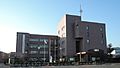
Shimizu Town Hall
-

Yusui-kun, the town's mascot


See also
 In Spanish: Shimizu (Shizuoka) para niños
