Shire Brook facts for kids
Shire Brook is a small stream in the south-eastern part of Sheffield, England. It starts in the Gleadless Townend area and flows east for about 6.5 kilometers (4 miles). The brook then joins the River Rother near Beighton and Woodhouse Mill.
For a long time, Shire Brook was an important border. It separated the counties of Yorkshire and Derbyshire. It also marked the boundary between the church areas of Canterbury and York. In the 20th century, people changed the brook's path. It now flows underground through tunnels called culverts in some places. These areas used to be old rubbish dumps or large railway yards.
Contents
Where Shire Brook Flows
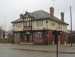
Shire Brook begins as an underground spring. It is located about 192 meters (630 feet) above sea level. You can find it beneath the Red Lion pub in Gleadless Townend. The brook flows in a culvert from under the pub. Then it comes out into the open between Seagrave Crescent and Lister Crescent.
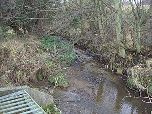
At first, it flows northeast. It goes under houses and then appears in Jaunty Park. Here, it looks like a small stream with some rubbish. Another stream from Hollinsend Park joins it. After about 1.5 kilometers (0.9 miles), it goes under the A6135 road. Then it turns east and disappears underground again. It flows for almost 1 kilometer (0.6 miles) through a culvert. This culvert is under the former Normanton Spring landfill site. This site has now been made into a park with trees.
The brook then comes out and continues its journey east. It flows through Wickfield Heath and under the A57 road. After this, it goes through the Shire Brook Valley Local Nature Reserve. Here, another stream joins it. This stream starts at Birley Spa, about 100 meters (328 feet) above sea level. It flows down a small valley to meet Shire Brook.
Shire Brook then goes underground again. It runs beneath the former Beighton Road landfill site. This is just north of Beighton. After this, it enters a wet area called Beighton Marsh. Many birds live here. The last 200 meters (219 yards) of Shire Brook's journey are also underground. It flows under the old Woodhouse Junction railway sidings. This land is now empty. Shire Brook finally enters the River Rother. This happens at about 37 meters (121 feet) above sea level.
History of Shire Brook
An Old Border
Shire Brook has been an important border for over a thousand years. In Anglo-Saxon times, it marked the edge between the kingdoms of Mercia and Northumbria. For 900 years, the brook was the border between Yorkshire and Derbyshire. This is how it got its name, "Shire Brook," as "shire" means a county. People also called it County Brook or Der Brook. Another old name was Ochre Dike. This was because water from mines in the valley made the brook look yellow-brown.
In 1967, the city of Sheffield grew bigger. It took in areas like Hackenthorpe and Mosborough. So, the brook no longer marked the border between the two counties. However, the brook still marks the boundary between the church areas of York and Canterbury.
Old Industries
Before the early 1700s, the Shire Brook valley was mostly farmland. But industries started to grow there. As early as the mid-1500s, Christopher Chapman was making cutlery at Carr Forge.
Like many streams in Sheffield, Shire Brook's water power was used. It turned water wheels for factories before steam and electricity were common. In the 1800s, five water wheels worked in the valley. They helped sharpen tools like scythes and sickles. Some of the small ponds that fed these water wheels still exist today.
The Upper and Lower Sickle wheels were in the Normanton Spring area. This was about 1.5 kilometers (0.9 miles) from where the brook starts. Further downstream were Carr Forge and Rainbow Forge. The Cliff Wheel was located less than 1 kilometer (0.6 miles) from where the brook joins the River Rother. The Staniforth family, who ran the Thomas Staniforth & Co sickleworks, used these wheels.
The dam at Rainbow Forge no longer holds water. It is hard to find its old walls among the plants. Carr Forge Dam is the best-preserved water area in the valley. But its wheel and old cottages are gone. In 1988, people dug up the site of the Lower Sickle Wheel. They found the foundations of the mill buildings and the pits where the grinding wheels were.
Small-scale coal mining started in the valley in the early 1700s. But large amounts of coal were taken out when the Birley Collieries opened. Birley West Colliery was just south of Normanton Spring. It mined coal from 1855 to 1908. Birley East opened in 1888. It was between Hackenthorpe and Woodhouse and worked until 1948. Shire Brook was put into culverts under both these places. When the mines closed, these sites became landfill areas. Both landfill sites have been covered and landscaped in recent years.
Shire Brook Valley Local Nature Reserve
The Shire Brook Valley Local Nature Reserve was created in 1999. It covers about 100 hectares (247 acres). The reserve is built around the old Coisley Hill Sewage Works, which closed in the early 1990s. The old office building is now a visitors' center.
The reserve includes Beighton Marsh. This is a wet area with lots of reed-grass. It is home to birds like the reed bunting, grasshopper warbler, and barn owl. You can also find small mammals like the harvest mouse and water vole here. The Birley Spa Bath House is an old building that was fixed up in 2001.
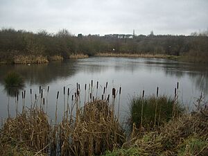
Also in the reserve is Wickfield Plantation. This is one of the few remaining areas of lowland heathland and coppiced oak woodland in Sheffield. The reserve has Carr Forge Dam. This dam is fed by the stream from Birley Spa. It is a great place for wildlife. New ponds were made in the same area in 1993. This was to celebrate 100 years of the City of Sheffield. Clive Betts opened the Centenary Ponds on June 18, 1993.
Pollution and Cleanup
For many years, Shire Brook was very polluted. This was because storm drains sometimes carried raw sewage into the brook. This sewage then flowed into the River Rother. In the early 1990s, the River Rother was known as one of the most polluted rivers in Europe.
In 2005 and 2006, a lot of work was done to control the pollution. Several large tanks were built in the Shire Brook valley. These tanks store storm water to prevent sewage from overflowing into the brook. In 2006, Yorkshire Water was fined because pumps failed at a sewage station. This allowed untreated sewage to flow into an 800-meter (875-yard) part of the brook.
 | Anna J. Cooper |
 | Mary McLeod Bethune |
 | Lillie Mae Bradford |


