
Shulaps Range facts for kids
Quick facts for kids Shulaps Range |
|
|---|---|

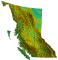
Location of Shulaps Range
|
|
| Highest point | |
| Peak | Shulaps Peak |
| Elevation | 2,880 m (9,450 ft) |
| Dimensions | |
| Area | 723 km2 (279 sq mi) |
| Geography | |
| Country | Canada |
| State/Province | British Columbia |
| Range coordinates | 50°55′N 122°25′W / 50.917°N 122.417°W |
| Parent range | Chilcotin Ranges |
The Shulaps Range is a group of mountains in southwest-central British Columbia, Canada. It is part of the larger Chilcotin Ranges, which are themselves a section of the huge Coast Mountains. This mountain range stretches about 55 kilometers (34 miles) from northwest to southeast. It is also about 15 kilometers (9 miles) wide from southwest to northeast. The total area of the Shulaps Range is about 2,970 square kilometers (1,150 square miles).
The mountains in the Shulaps Range are quite tall. Their tops are often dry and rocky, but some areas have very small icefields, which are like small glaciers. The two highest peaks are Shulaps Peak, standing at 2,880 meters (9,449 feet) high, and Big Dog Mountain, which is 2,862 meters (9,390 feet) tall. Another important peak is Rex Peak, at 2,684 meters (8,806 feet). Rex Peak has a cone shape and stands out at the southern end of the range. It is bordered by the steep walls of the Bridge River Canyon.
Contents
Exploring the Shulaps Range: Location and Features
The northeast side of the Shulaps Range has many high, bowl-shaped areas called basins. Many of these basins hold beautiful alpine lakes. Roads can reach high into different parts of the range, making some areas easier to explore. People have found valuable minerals here. For example, there is an active gold mining area on the south side of Big Dog Mountain, near Blue Creek. Also, at the far southeast end, in the Hell Creek basin, there used to be a working jade mine.
Where is the Shulaps Range Located?
The southeast edge of the Shulaps Range forms the western rim of the deep Bridge River Canyon. Just below this canyon, to the northeast, the Bridge River meets the Yalakom River. This meeting point marks the range's northeastern border. To the west, across Tyaughton Creek and upper Churn Creek, is the South Chilcotin area. This area is known for its natural beauty and includes places like the Spruce Lake Protected Area and Big Creek Provincial Park.
Looking east across the Yalakom River, you will find the Camelsfoot Range. To the south, you can see the Bendor Range. The town of Lillooet is located to the southeast, close to the southern tip of the Camelsfoot Range.
Best Views of the Shulaps Range
One of the best ways to see the Shulaps Range is from the old site of Minto City. This spot is where Gun Creek meets the Bridge River, which is now part of Carpenter Lake Reservoir. From here, and along the upper part of Carpenter Lake, the western side of the range is a common sight for people traveling on BC Highway 40. This highway connects towns like Bralorne and Gold Bridge to Lillooet.
Understanding the Name: Shulaps Range
The name "Shulaps" comes from the St'̓át'̓imcets language. It is an English version of their word for a male mountain sheep, also known as a ram. The nearby Yalakom River is also named after a mountain sheep, but for a female one, called an ewe.
This area was once very rich in big game animals, like mountain sheep. The names suggest that it was a great place for hunting. The Yalakom valley and the Shulaps Range were shared hunting grounds. Both the St'át'imc people and the Tsilhqot'in people used these lands for hunting.
Images for kids
-
Location of Shulaps Range
