Shute Harbour facts for kids
Quick facts for kids Shute HarbourQueensland |
|||||||||||||||
|---|---|---|---|---|---|---|---|---|---|---|---|---|---|---|---|

Shute Harbour
|
|||||||||||||||
| Population | 113 (2021 census) | ||||||||||||||
| • Density | 113/km2 (290/sq mi) | ||||||||||||||
| Postcode(s) | 4802 | ||||||||||||||
| Area | 1.0 km2 (0.4 sq mi) | ||||||||||||||
| Time zone | AEST (UTC+10:00) | ||||||||||||||
| Location |
|
||||||||||||||
| LGA(s) | Whitsunday Region | ||||||||||||||
| State electorate(s) | Whitsunday | ||||||||||||||
| Federal Division(s) | Dawson | ||||||||||||||
|
|||||||||||||||
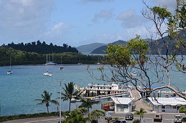
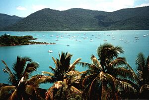
Shute Harbour is a small coastal area and a busy harbour in Queensland, Australia. It's located in the Whitsunday Region. This place is a main starting point for people wanting to visit the beautiful Whitsunday Islands and other holiday spots nearby.
In 2021 census, about 113 people lived in Shute Harbour.
Contents
Exploring Shute Harbour's Location
Shute Harbour is found right on the coast. The main road, called Proserpine–Shute Harbour Road (State Route 59), leads directly into the area. It ends at the harbour's car park.
Coastal Features
Shute Harbour has several interesting spots along its coast:
- Shute Bay: A calm bay to the west.
- Rooper Inlet: Another bay, a bit further east.
- Shute Harbour: The main harbour area itself.
- Coral Point: A small piece of land that sticks out into the sea.
Besides the harbour services, there are only a few homes on the Coral Point peninsula.
A Look at Shute Harbour's Past
Shute Harbour got its name from Shute Island. This island is about 500 metres (1,600 ft) south-east of the harbour's headland. Captain John Fiot Lee Pearse Maclear of HMS Alert named the island in May 1881. He might have named it after someone on his ship.
Town Changes Over Time
In October 1960, the local council decided to build tourist facilities here. They created a town called Shutehaven. Later, on January 31, 1987, Shutehaven became part of a larger town called Whitsunday.
Harbour Upgrades and Safety
The Whitsunday Regional Council opened a newly updated Shute Harbour Marine Terminal in December 2021. However, some people had concerns about the public boat ramp. The main worry was that the jetty would go underwater at high tide. This meant boat users had to walk through water to reach their boats. In August 2023, the council announced they would review the boat ramp to make sure it was safe for everyone.
People Living in Shute Harbour
In 2016 census, 122 people lived in Shute Harbour. By 2021 census, the population was 113 people.
Schools Near Shute Harbour
There are no schools directly in Shute Harbour. Students usually go to school in nearby towns. The closest primary school is Cannonvale State School in Cannonvale. For high school, students attend Proserpine State High School in Proserpine.
What You'll Find at the Harbour
Shute Harbour is a very busy place with many boats. Different companies offer services like:
- Renting boats (bareboats)
- Chartered yachts for trips
- Day tours to the islands
- Regular ferry services
- Water taxis and seaplane rides
Public Access Points
There's a public boat ramp on Shute Harbour Road. This is where people can launch their own boats. The Whitsunday Regional Council manages this ramp. There is also a public jetty where people can go fishing.
Getting Around
Regular bus services connect Shute Harbour to other towns. These buses travel through Conway National Park to places like Proserpine, Cannonvale, and Airlie Beach.


