Shuteye Peak facts for kids
Quick facts for kids Shuteye Peak |
|
|---|---|

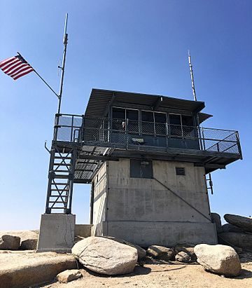
The Shuteye Peak Lookout tower in the Sierra National Forest.
|
|
| Highest point | |
| Elevation | 7,544 ft (2,299 m) NAVD 88 |
| Prominence | 1,311 ft (400 m) |
| Geography | |
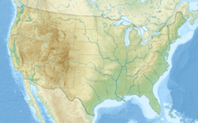
| Location | Sierra National Forest, Madera County, California, U.S. |
| Parent range | Sierra Nevada |
| Topo map | USGS Shuteye Peak, CA |
| Climbing | |
| Easiest route | Trail hike (class 1) |
Shuteye Peak is a cool mountain in the Sierra National Forest in Madera County, California. It's a great spot to see amazing views of the area. From the top, you can look out over the San Joaquin Valley, Mammoth Mountain, Bass Lake, and the North Fork areas.
This mountain is also home to one of the last active fire lookouts in California. These towers are super important for spotting wildfires early.
You can reach Shuteye Peak by a main trail. This trail starts north of Central Camp. The United States Forest Service uses it to bring supplies to the fire lookout. Hikers and mountain bikers love this trail in the summer. It's a steep path with many rocky parts made of a type of rock called quartz monzonite.
The Fire Lookout Tower
The Shuteye Lookout was first set up by the U.S. Forest Service in 1907. The building you see today was built in 1957. It has a steel room, 14 by 14 feet, with a flat roof. This room sits on a concrete base that is 10 by 10 feet.
In 2012, a weather station was added to the lookout. Shuteye is one of the few fire lookouts still actively used in the Sierra Nevada mountains. In 2017, a Forest Service worker named Richard Bushnell was at Shuteye Peak. He was one of the first to see the Railroad Fire starting. This shows how important these lookouts are for safety!
Nature and Wildlife
Shuteye Peak is a special place for nature. Its forests are found at high elevations. These are called upper montane and subalpine forests.
This area is the only known home for a rare flower called the Shuteye Peak fawn lily. This beautiful lily is listed as an endangered species. This means it is very important to protect its home on Shuteye Peak. The California Department of Fish and Wildlife helps to protect it.
Images for kids
 | Stephanie Wilson |
 | Charles Bolden |
 | Ronald McNair |
 | Frederick D. Gregory |


