Silver Bell Mountains facts for kids
Quick facts for kids Silver Bell Mountains |
|
|---|---|

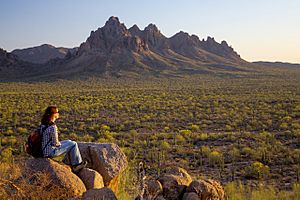
Ragged Top is a prominent landmark just north of the main range of the Silver Bell mountains
|
|
| Highest point | |
| Peak | Silver Bell Peak |
| Elevation | 4,261 ft (1,299 m) |
| Dimensions | |
| Length | 6 mi (9.7 km) N-NW x SE |
| Width | 5 mi (8.0 km) |
| Geography | |
| Country | United States |
| State | Arizona |
| Region | Ironwood Forest National Monument (northeast)-Sonoran Desert (Avra Valley) |
| District | Pima County |
| Settlement | Silver Bell, AZ |
| Borders on | West Silver Bell Mountains-NW Waterman Mountains-S Aguirre Valley-W & SW Avra Valley-E & I-10-NE |
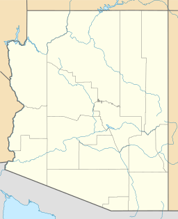
The Silver Bell Mountains are a mountain range in north-central Pima County, Arizona. They stretch from northwest to southeast. You can find them about 14 miles (22 km) west of Marana, Arizona, a town near Interstate-10. They are also northwest of Tucson.
These mountains are just east of the Ironwood Forest National Monument. A famous spot in the northern part of the range is Ragged Top. It's a well-known landmark, especially since this area used to be important for mining.
About the Silver Bell Mountains
The Silver Bell Mountains get their name from the Silver Bell Mine. This mine is located at the southern end of the mountains. The range is next to the Waterman Mountains to the southeast.
Both the Silver Bell Mountains and the Waterman Mountains are in the northeast part of the Sonoran Desert. You can get to the Silver Bell range by using Avra Valley Road and Silver Bell Road from the south of Marana.
Weather in the Mountains
The weather in the Silver Bell Mountains can change a lot. This area has a "semi-arid" climate. This means it's a dry place, like a steppe or desert, but it's not as extreme as some deserts.
Here's a quick look at the average temperatures and rainfall:
| Climate data for Silver Bell Mountains | |||||||||||||
|---|---|---|---|---|---|---|---|---|---|---|---|---|---|
| Month | Jan | Feb | Mar | Apr | May | Jun | Jul | Aug | Sep | Oct | Nov | Dec | Year |
| Mean daily maximum °F (°C) | 63 (17) |
66 (19) |
71 (22) |
79 (26) |
88 (31) |
98 (37) |
98 (37) |
96 (36) |
93 (34) |
84 (29) |
72 (22) |
62 (17) |
81 (27) |
| Mean daily minimum °F (°C) | 43 (6) |
46 (8) |
49 (9) |
55 (13) |
63 (17) |
72 (22) |
74 (23) |
72 (22) |
70 (21) |
61 (16) |
51 (11) |
43 (6) |
58 (14) |
| Average precipitation inches (mm) | 0.9 (23) |
0.9 (23) |
0.8 (20) |
0.2 (5.1) |
0.2 (5.1) |
0.3 (7.6) |
2.5 (64) |
2.5 (64) |
1.3 (33) |
1 (25) |
0.8 (20) |
1.3 (33) |
12.8 (330) |
| Source: Weatherbase | |||||||||||||
 | William L. Dawson |
 | W. E. B. Du Bois |
 | Harry Belafonte |


