West Silver Bell Mountains facts for kids
Quick facts for kids West Silver Bell Mountains |
|
|---|---|
| Highest point | |
| Peak | Solo Peak (West Silver Bell Mountains) |
| Elevation | 2,747 ft (837 m) |
| Dimensions | |
| Length | 10 mi (16 km) NW-SE |
| Width | 4 mi (6.4 km) |
| Geography | |
| Country | United States |
| Settlement | Saguaro |
| Range coordinates | 32°30′12″N 111°40′25″W / 32.503401°N 111.673734°W |
| Topo map | USGS Silver Bell West, Greene Reservoir and Gap Tank 7.5 Min. Quads |
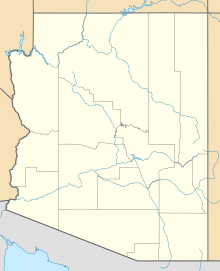
The West Silver Bell Mountains are a small mountain range in south-central Arizona, United States. They are about 10 miles (16 km) long. These mountains are found in the dry, northern part of the Sonoran Desert. This desert is known for its unique plants and animals.
Most of the range is in Pima County. A small part of the northern end reaches into Pinal County. The mountains are about 25 miles west of Marana. They are also 25 miles south of Eloy and Casa Grande. These cities are all located near Interstate 10 in Arizona.
Contents
Exploring the West Silver Bell Mountains
The West Silver Bell Mountains are a small range with low elevations. They are located in the eastern part of Arizona's Sonoran Desert. Areas further west or southwest are even drier. This is because they get closer to the very dry Gran Desierto de Altar in Mexico.
How the Mountains Are Shaped
The West Silver Bell Mountains run from northwest to southeast. They connect with the Silver Bell Mountains in the southeast. Both mountain ranges get their name from the old town of Silver Bell. They are also named after the Silver Bell Mine, which is in the southern part of the main Silver Bell Mountains.
The southwest end of the Sawtooth Mountains is about 10 kilometers (6 miles) to the northwest. To the west, across a place called Aguirre Valley, you can find the Slate Mountains and the Santa Rosa Mountains.
Nearby Valleys and Communities
The West Silver Bell Mountains are northeast of the Aguirre Valley. This valley is about 35 miles (56 km) long. It runs from northwest to southeast. Five other low mountain ranges surround this valley. The valley is part of a type of land called "Basin and Range." This means it has long valleys next to long mountain ranges.
The northern part of the valley joins a flat area near where the Santa Cruz River meets the Gila River. The community of Saguaro is located at the southeastern base of the West Silver Bell Mountains. It is also next to the foothills of the main Silver Bell range.
Highest Points in the Range
The highest point in the West Silver Bell Mountains is Solo Peak. It stands at 2,747 feet (837 meters) tall. You can find Solo Peak on the northwest end of the range.
At the southeastern end of the range, there is another hill called Malpais Hill. It is 2,682 feet (817 meters) high. Malpais Hill is also connected to the northwestern part of the Silver Bell Mountains.
Protected Lands
A part of the West Silver Bell Mountains that is in Pima County is inside the Ironwood Forest National Monument. This monument helps protect the unique desert plants and animals that live there.
 | Mary Eliza Mahoney |
 | Susie King Taylor |
 | Ida Gray |
 | Eliza Ann Grier |


