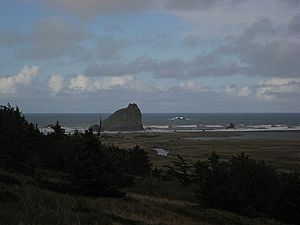
Sixes River facts for kids
The Sixes River is a river in southwestern Oregon, United States. It flows for about 31 miles (50 kilometers) through beautiful coastal forests. This river helps drain a wild area of the Klamath Mountains near the Pacific Ocean, just north of a town called Port Orford.
Quick facts for kids Sixes River |
|
|---|---|

Near the river mouth
|
|
|
Location of the mouth of Sixes River in Oregon
|
|
| Country | United States |
| State | Oregon |
| County | Curry |
| Physical characteristics | |
| Main source | Klamath Mountains near Sugarloaf Mountain, Rogue River – Siskiyou National Forest 1,064 ft (324 m) 42°51′12″N 124°09′18″W / 42.85333°N 124.15500°W |
| River mouth | Pacific Ocean Cape Blanco 0 ft (0 m) 42°51′13″N 124°32′38″W / 42.85361°N 124.54389°W |
| Length | 31 mi (50 km) |
| Basin features | |
| Basin size | 134 sq mi (350 km2) |
The Sixes River starts high up in the mountains of northern Curry County. Its source is near Sugarloaf Mountain within the Rogue River – Siskiyou National Forest. From there, it flows mostly west. It passes through the Grassy Knob Wilderness and a small town also called Sixes. Finally, the river reaches the Pacific Ocean just north of Cape Blanco. Cape Blanco is the westernmost point in Oregon. The river's mouth is part of Cape Blanco State Park.
How Did Sixes River Get Its Name?
There are different stories about how the Sixes River got its unique name. One idea is that it was named after a Native American chief. Another story says that in the early 1850s, people often called it the "Sikhs River." This name came from the Chinook Jargon word for "friend."
Some old maps even show it as the "Sequalchin River." The Native American name for the river was "Sa-qua-mi." A book about Native American tribes suggests that a local group, the Kwatami, had a name variant "Sik-ses-tene." This means "people by the far north country." This might be the true origin of the name.
However, the spelling "Sixes" likely became popular because of miners. These miners came to Oregon during the gold rush. They were familiar with the Chinook word "sikhs." The spelling "Sixes" has been used since at least 1855.
Copper Salmon Wilderness: A Special Place
In 2009, a large area of about 13,700 acres (55 square kilometers) was named the Copper Salmon Wilderness. This special area includes parts of the Elk River and the upper Middle Fork Sixes River. It is a protected place where nature can thrive.
This wilderness is home to one of the biggest low-elevation old-growth forests in the United States. Old-growth forests are very old forests with huge trees that have been growing for centuries. Many different animals live here. You can find salmon, steelhead, and coastal cutthroat trout in the rivers. Birds like marbled murrelets and northern spotted owls also live in the trees. Large animals like Roosevelt elk roam through the forests.
Tributaries: Smaller Streams Joining the River
The Sixes River is fed by many smaller streams and creeks. These are called tributaries. They flow into the main river, adding to its water. Some of the named tributaries that join the Sixes River are:
- Murphy Canyon
- Haines Creek
- North Fork Sixes River
- Sugar Creek
- Sucker Creek
- Middle Fork Sixes River
- Big Creek
- Otter Creek
- South Fork Sixes River
- Elephant Rock Creek
- Little Dry Creek
- Pipeline Creek
- Dry Creek
- Edson Creek
- Koch Creek
- Jenny Creek
- Beaver Creek
- Crystal Creek
- Sullivan Gulch
 | Emma Amos |
 | Edward Mitchell Bannister |
 | Larry D. Alexander |
 | Ernie Barnes |


