Slab Fork facts for kids
Quick facts for kids Slab Fork |
|
|---|---|

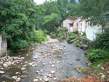
Slab Fork in Mullens in 2007
|
|
|
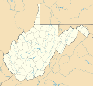
Location of the mouth of the Slab Fork in Mullens, West Virginia
|
|
| Country | United States |
| State | West Virginia |
| Counties | Raleigh, Wyoming |
| Physical characteristics | |
| Main source | south of Lester 2,364 ft (721 m) 37°42′32″N 81°17′31″W / 37.7090031°N 81.2920465°W |
| River mouth | Guyandotte River Mullens 1,411 ft (430 m) 37°34′54″N 81°22′54″W / 37.5817809°N 81.3817692°W |
| Length | 15.1 mi (24.3 km) |
| Basin features | |
| Basin size | 35.36 sq mi (91.6 km2) |
The Slab Fork is a small river in southern West Virginia, United States. It is about 15.1 miles (24.3 km) long. The Slab Fork is a tributary of the Guyandotte River. This means it's a smaller stream that flows into a larger river.
The water from the Slab Fork eventually joins the Ohio River and then the mighty Mississippi River. All the land that drains water into the Slab Fork is called its watershed. This watershed covers about 35.36 square miles (91.6 km2). It is mostly a rural area with hills.
Where the Slab Fork Begins
The Slab Fork starts in Raleigh County. Its source is about 2 miles (3.2 km) south of a town called Lester. It is also about 2.5 miles (4.0 km) west of Sophia.
The River's Journey
The river first flows southwest. It passes through the communities of Slab Fork and Hotchkiss. Then it enters eastern Wyoming County.
In Wyoming County, the Slab Fork turns and flows south. It goes through several more communities. These include Maben, Pierpont, and Otsego.
Slab Fork's End Point
Finally, the Slab Fork reaches the city of Mullens. Here, it flows into the Guyandotte River from the north. A road, West Virginia Route 54, runs alongside the river between Slab Fork and Mullens.
Land Around the River
In 1992, scientists looked at how the land around the Slab Fork was used. They found that most of the land, about 95%, was covered by forests. A small part, about 2%, was used for farming. Another small part, about 1%, was used for businesses or mining.
 | Frances Mary Albrier |
 | Whitney Young |
 | Muhammad Ali |


