Slieve Muck facts for kids
Quick facts for kids Slieve Muck |
|
|---|---|
| Sliabh Muc | |

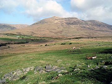
The southern slopes of Slieve Muck
|
|
| Highest point | |
| Elevation | 670.4 m (2,199 ft) |
| Prominence | 156 m (512 ft) |
| Listing | Marilyn, Hewitt |
| Geography | |
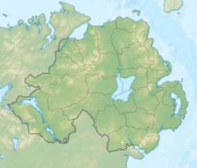
| Location | County Down, Northern Ireland |
| Parent range | Mourne Mountains |
| OSI/OSNI grid | J282250 |
| Topo map | OSNI Landranger 29, OSNI Outdoor Pursuits map Mourne Country |
Slieve Muck (sleev-_-muk) is a mountain found in the beautiful Mourne Mountains. It is located in County Down, Northern Ireland. The name Slieve Muck comes from the Irish language, meaning "pig mountain."
This mountain stands at a height of about 670.4 meters (2,199 feet). An important river, the River Bann, actually starts its journey on the northern side of Slieve Muck.
What is Slieve Muck Like?
Slieve Muck has three main tops, which are called summits. These summits are mostly made of a type of rock called Silurian shale. This shale rock sits on top of older granite rock.
Slieve Muck's Slopes
On the eastern side of the mountain, the shale rock forms a steep cliff-like edge. This is known as an escarpment. Below this steep edge, the eastern slope is covered in loose, stony debris called scree.
The western side of Slieve Muck is covered in grass. Many small streams flow down this grassy slope. These streams eventually reach an area below called Deer's Meadow.
The "Poverty Mountain" Nickname
If you look closely at the stony eastern slope from a distance, you might notice something interesting. Lighter-colored areas of rock seem to form the letters "POV." Local people have used their imagination to complete this into the word "Poverty." Because of this, Slieve Muck is sometimes also called "Poverty Mountain."
 | Victor J. Glover |
 | Yvonne Cagle |
 | Jeanette Epps |
 | Bernard A. Harris Jr. |


