Slieve Rushen facts for kids
Quick facts for kids Slieve Rushen |
|
|---|---|
| Sliabh Roisean | |

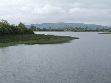
Slieve Rushen from Upper Lough Erne
|
|
| Highest point | |
| Elevation | 404 m (1,325 ft) |
| Prominence | 404 m (1,325 ft) |
| Listing | Marilyn |
| Geography | |
|
Lua error in Module:Location_map at line 420: attempt to index field 'wikibase' (a nil value).
|
|
| Location | Cavan, Ireland |
Slieve Rushen is a mountain located on the border. It sits between County Cavan in the Republic of Ireland and County Fermanagh in Northern Ireland. People sometimes call it Slieve Russell or Ligavegra. This mountain stands 404 metres (about 1,325 feet) above sea level.
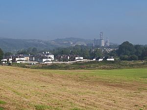
The mountain is mostly made of grey limestone. It has a top layer of sandstone and shale rocks. Local companies often quarry (dig up) these rocks. The surface of Slieve Rushen is covered with peat (decayed plant matter), conifer forests, and fields for grazing animals.
You can find several caves and "swallow-holes" (places where water disappears underground) here. These include Pollnagollum and Tory Hole. They are popular spots for potholers, who explore caves. Slieve Rushen is also part of a special nature area called the Slieve Rushen Bog Natural Heritage Area. A newer addition to the mountain is the Slieve Rushen Wind Farm, which helps make electricity.
What's in a Name?
The name Slieve Rushen comes from the old Gaelic words Sliabh Ros-in. This means "The Mountain of the Little Wood."
However, there is another old story about the name. A text from around 1400, called The Settling of the Manor of Tara, says the mountain was named after a woman. She was called "daughter of Toga of the grey stormy sea."
The name Slieve Rushen is very old. It appears in ancient Irish writings. For example, it is mentioned in the Lebor Gabála Érenn (Book of Invasions) from about 1100. It also shows up in the Annals of the Four Masters from 1111 AD. These old texts show that the mountain has been known by this name for a very long time.
A Look at History
People have lived on and around Slieve Rushen for a very long time. We know this because of ancient burial sites found there. These include court cairns and wedge tombs. You can still see them in areas like Doon (Tomregan) and Aughrim. These structures show that people lived here as far back as 3,000 B.C.
In the early 1600s, during the Plantation of Ulster, land on the mountain was given away. John Sandford received parts of Slieve Rushen in 1613. Later, he sold the mountain to Toby Caulfeild. The mountain was also partly owned by John Sandford's daughter, Magdalen Gwyllym. She was married to Thomas Gwyllym, who owned the nearby Ballyconnell estate.
Slieve Rushen also played a role in Irish history. After a big battle in 1650, during the Irish Confederate Wars, some defeated Irish rebels hid around "Sleaue Russell." Also, during the 1641 Rebellion, a famous fighter named Myles 'The Slasher' O'Reilly fought a battle on Slieve Russell.
 | Jessica Watkins |
 | Robert Henry Lawrence Jr. |
 | Mae Jemison |
 | Sian Proctor |
 | Guion Bluford |


