Sligo Bay facts for kids
Quick facts for kids Sligo Bay |
|
|---|---|

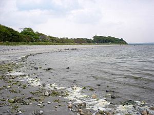
Sligo Bay from Knocknarea
|
|
 |
|
| Location | County Sligo |
| Coordinates | 54°17′56″N 8°38′43″W / 54.29889°N 8.64528°W |
| Ocean/sea sources | Atlantic Ocean |
| Basin countries | Ireland |
| Islands | Coney, Oyster, Maguins |
| Settlements | Sligo, Rosses Point, Ballysadare, Drumcliff |
Sligo Bay (which is called Cuan Shligigh in Irish) is a beautiful natural bay in County Sligo, Ireland. It is a part of the vast Atlantic Ocean. Many towns and villages are located around its shores, including Sligo town itself.
Contents
Exploring Sligo Bay
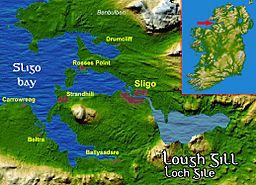
Sligo Bay opens up between two points of land: Aughris Head to the south and Roskeeragh Point to the north. Inside the bay, there are three smaller areas where rivers meet the sea. These rivers are the Drumcliff, Garavogue, and Bonet.
The Garavogue River flows into the middle part of the bay, which is called Sligo Harbour. This harbour is separated from the wider bay by three small islands: Coney, Oyster, and Maguins. Another river, the Ballisodare River, also flows into the southern part of Sligo Bay, near the village of Ballysadare.
Islands and Peninsulas
The bay has many peninsulas, which are pieces of land almost surrounded by water. These peninsulas create large sandy beaches, especially when the tide is low. There are also tidal islands, which you can only reach by walking across the sand when the tide is out.
Some of the important landforms and islands in Sligo Bay are:
- Maugherow Peninsula
- Rosses Point Peninsula
- Coolera Peninsula
- Oyster Island
- Coney Island
- Maguins Island
History of Sligo Bay
The large beaches and flat areas around Sligo Bay are perfect places for shellfish to live. This made the bay a great spot for people to settle, even as far back as the Stone Age. Archaeologists have found many ancient shell heaps, called middens, which show that people lived and ate here a very long time ago.
Over the centuries, many ships have been wrecked in the waters of Sligo Bay. One famous shipwreck was the Labia, a large Venetian ship that sank on September 25, 1588. Shipwrecks became quite common in the bay. However, their number started to decrease in the 20th century as the port of Sligo became less busy.
Travel and Transport
Sligo Airport is located right on the shore of Sligo Bay. It sits at the base of Knocknarea, a well-known hill that looks over the peninsula between Sligo Harbour and Ballysadare Bay.
Lighthouses of Sligo Bay
There are four lighthouses that guide ships safely in and out of Sligo Bay.
Blackrock (Sligo) Lighthouse
The Blackrock Lighthouse is 25 meters tall. It is special because it has steps on the outside that go halfway up the tower. Its location is 54°18′28″N 8°37′4″W / 54.30778°N 8.61778°W.
Lighthouses near Rosses Point
- Further information: Rosses Point#Lighthouses
Near the area of Rosses Point, Sligo Bay has three more lighthouses: the Metal Man, Lower Rosses, and Oyster Island lighthouses. They all help ships navigate the waters.
Hiking and Exploring
Sligo Bay is part of the Donegal to Mayo section of the Wild Atlantic Way. This is a very long and scenic coastal route that is perfect for hiking and exploring the beautiful Irish coastline.
Nature and Wildlife
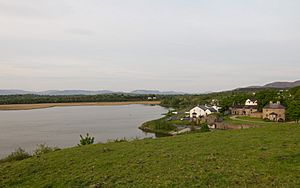
Ballysadare Bay is home to a well-known colony of seals. You can often see them resting on the rocks or swimming in the water.
The areas where the rivers meet the sea (the estuaries) are very important for nature. They are protected under European laws as a NATURA 2000 site. This means they are special places for wildlife. The area is also a Natural Heritage Area, which is managed by the Irish National Parks & Wildlife Service to protect its natural beauty and animals.
 | James B. Knighten |
 | Azellia White |
 | Willa Brown |


