Slioch facts for kids
Quick facts for kids Slioch |
|
|---|---|
| Scottish Gaelic: Sleaghach | |

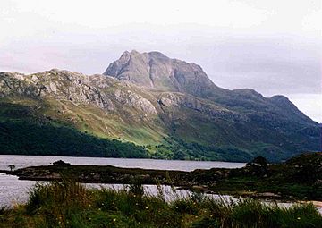
Slioch seen from the shores of Loch Maree.
|
|
| Highest point | |
| Elevation | 981 m (3,219 ft) |
| Prominence | 626 m (2,054 ft) |
| Parent peak | Sgurr Mor |
| Listing | Munro, Marilyn |
| Naming | |
| English translation | the spear |
| Language of name | Gaelic |
| Pronunciation | |
| Geography | |
| Location | Wester Ross, Scotland |
| OS grid | NH004688 |
| Topo map | OS Landranger 19, OS Explorers 433, 435 |
Slioch (which means "the spear" in Gaelic) is a famous mountain in the Scottish Highlands. It is located in Wester Ross, about eight kilometres north of Kinlochewe village. Slioch stands tall at 981 metres (3,218 feet).
This mountain rises dramatically above the southeast end of Loch Maree. It offers one of the most beautiful and photographed views in the Highlands. You can often see it from the A832 road. Even VisitScotland, the national tourist agency, has featured Slioch in its TV ads.
Contents
About Slioch Mountain
Slioch is made mostly of a type of rock called Torridonian sandstone. This sandstone sits on top of older rock known as Lewisian Gneiss. The mountain has very steep cliffs on three of its sides.
What's in a Name?
The name "Slioch" comes from the Gaelic word "sleagh," meaning "the spear." This name makes perfect sense when you see Slioch from Lochan Fada, which is to the northeast. From there, a smaller peak called Sgurr an Tuill Bhain (Peak of the White Hollow), which is 933 metres high, looks like a slender spear. This gives the whole mountain its unique name. You might even spot wild goats climbing on the mountain's slopes!
Climbing Slioch
Most people who climb Slioch start their journey from a place called Incheril. This spot is about one kilometre east of Kinlochewe. The first part of the walk is flat and easy.
The Approach Walk
You walk about five kilometres northwest along the Kinlochewe River. This path also follows the banks of Loch Maree. Along the way, you will pass an impressive waterfall. It is about 100 metres (328 feet) high. This waterfall flows down from Beinn a’ Mhuinidh and joins the river.
The Climb Begins
Once you reach the start of Gleann Bianasdail, the real climbing begins. You walk about one kilometre up this glen. Then, you find a path that turns left. This path leads you towards a large, open valley called Coire na Sleaghaich.
From there, you climb up the southeast ridge of Slioch. You will pass two small lakes, often called the 'twin lochans'. These lakes are a good landmark on your way to the summit.
Reaching the Summit
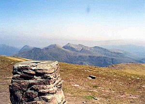
The top of Slioch has two main points, like twin peaks. The southern peak has a trig point, which is a marker used for surveying. It was once thought to be 980 metres high. The northern peak is right on the edge of the cliffs. It offers even better views.
In recent years, the Ordnance Survey (who map the UK) measured the northern peak as 981 metres. This makes it the highest point on Slioch.
Views from the Top
Because Slioch stands alone, away from other mountains, the view from its summit is amazing. You can see the vast wilderness of the Fisherfield Forest to the north. This area is home to five other famous mountains called Munros. You can also clearly see the Torridon mountains and the beautiful Loch Maree.
 | William M. Jackson |
 | Juan E. Gilbert |
 | Neil deGrasse Tyson |


