Snake River (Colorado) facts for kids
Quick facts for kids Snake River |
|
|---|---|

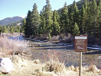
Snake River near Keystone
|
|
| Physical characteristics | |
| Main source | Summit County, Colorado 39°32′01″N 105°51′16″W / 39.53361°N 105.85444°W |
| River mouth | Dillon Reservoir Confluence with Blue at Dillon Reservoir 9,022 ft (2,750 m) 39°36′55″N 106°03′15″W / 39.61528°N 106.05417°W |
| Length | 15 mi (24 km) |
| Basin features | |
| Tributaries |
|
The Snake River is a small river in central Colorado, United States. It is about 15 miles (24 km) long. This river is a tributary of the Blue River. A tributary is a smaller stream or river that flows into a larger one.
The Snake River helps drain a mountain area in southeastern Summit County. This area is on the west side of the Front Range mountains, just east of a town called Keystone.
Where the Snake River Flows
The Snake River starts high up in the mountains. Its source is near the continental divide. This is a high ridge that separates river systems, sending water to different oceans. Here, it's near Webster Pass, on the border between Summit and Park counties.
From its start, the river flows down a very steep, narrow valley called a canyon. It goes north past an old mining town called Montezuma. After that, it turns west and flows past Keystone.
Finally, the Snake River joins the Blue River. It flows into the Blue River from the east, becoming part of the Dillon Reservoir.
 | Anna J. Cooper |
 | Mary McLeod Bethune |
 | Lillie Mae Bradford |

