Snyder, Oklahoma facts for kids
Quick facts for kids
Snyder, Oklahoma
|
|
|---|---|

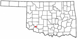
Location of Snyder, Oklahoma
|
|
| Country | United States |
| State | Oklahoma |
| County | Kiowa |
| Area | |
| • Total | 1.21 sq mi (3.12 km2) |
| • Land | 1.21 sq mi (3.12 km2) |
| • Water | 0.00 sq mi (0.00 km2) |
| Elevation | 1,352 ft (412 m) |
| Population
(2020)
|
|
| • Total | 1,301 |
| • Density | 1,079.67/sq mi (416.76/km2) |
| Time zone | UTC-6 (Central (CST)) |
| • Summer (DST) | UTC-5 (CDT) |
| ZIP code |
73566
|
| Area code(s) | 580 |
| FIPS code | 40-68400 |
| GNIS feature ID | 2411916 |
Snyder is a city located in Kiowa County, Oklahoma, in the United States. In 2020, about 1,301 people lived there.
Contents
Snyder's Early Days: A Look at Its History
The town of Snyder started in 1902 in what was then called Oklahoma Territory. It was built about 2 miles (3.2 km) south of Mountain Park. The person who founded the town was Charles G. Jones. He was the president of the Oklahoma City and Western Railroad. Jones named the new town after Bryan Snyder, who worked for the St. Louis and San Francisco Railway (also known as Frisco). This railway line ran right through the town.
Challenges and Growth in Snyder's History
In 1905, a very strong tornado hit Snyder. It sadly caused the deaths of 113 people, including the head of the public schools. Later, fires in 1906 and 1909 destroyed most of the wooden buildings on Main Street. However, the town quickly rebuilt with stronger brick buildings. By 1907, when Oklahoma became a state, Snyder had 607 residents. This number grew to 1,122 people by 1910.
Where is Snyder? Understanding Its Geography
Snyder is located where two main roads meet: U.S. Route 62 and U.S. Route 183. It is about 28 miles (45 km) south of Hobart. Snyder is also 22 miles (35 km) east of Altus and 36 miles (58 km) west of Lawton.
The United States Census Bureau says that Snyder covers a total area of about 1.3 square miles (3.4 km2). All of this area is land.
Snyder's Population Over Time: Demographics
| Historical population | |||
|---|---|---|---|
| Census | Pop. | %± | |
| 1910 | 1,122 | — | |
| 1920 | 1,197 | 6.7% | |
| 1930 | 1,195 | −0.2% | |
| 1940 | 1,278 | 6.9% | |
| 1950 | 1,646 | 28.8% | |
| 1960 | 1,663 | 1.0% | |
| 1970 | 1,671 | 0.5% | |
| 1980 | 1,848 | 10.6% | |
| 1990 | 1,619 | −12.4% | |
| 2000 | 1,509 | −6.8% | |
| 2010 | 1,394 | −7.6% | |
| 2020 | 1,301 | −6.7% | |
| U.S. Decennial Census | |||
In the year 2000, there were 1,509 people living in Snyder. There were 607 households, and 398 of these were families. About 31.5% of households had children under 18 living with them. The average household had 2.41 people. The average family had 3.01 people.
The population was spread out by age. About 27.2% of the people were under 18 years old. About 18.8% were 65 years or older. The average age in the city was 38 years.
Snyder's Economy: Farming and Ranching
The economy in Snyder and the areas around it mainly depends on farming and ranching. Important crops grown here include cotton, corn, wheat, and hay.
Fun Things to Do: Parks and Recreation Near Snyder
There are several fun places to visit near Snyder:
- Great Plains State Park is about 6.9 miles (11.1 km) north of town. It is located on Tom Steed Reservoir.
- The Wichita Mountains Wildlife Refuge is about 14.5 miles (23.3 km) northeast. This is a great place to see nature and wildlife.
- The unique cobblestone community of Medicine Park is about 16.1 miles (25.9 km) east-northeast. It is located on Lake Lawtonka.
- Lake Frederick is about 18 miles (29 km) south-southeast of Snyder.
Famous People From Snyder
- James V. McClintic (1878–1948) was a politician, lawyer, and farmer. He moved to Snyder in 1902.
- Jack L. Treadwell (1919–1977) was a highly decorated U.S. Army officer. He was living in Snyder when he joined the army in 1941.
See also
 In Spanish: Snyder (Oklahoma) para niños
 | Precious Adams |
 | Lauren Anderson |
 | Janet Collins |

