Soda Lakes facts for kids
Quick facts for kids Soda Lakes |
|
|---|---|

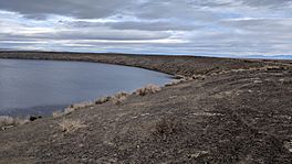
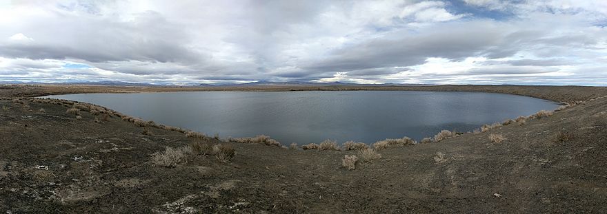
east rim of Big Soda Lake
|
|
| Location | Churchill County, Nevada, US |
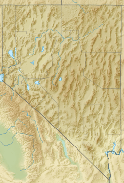
| Coordinates | 39°31′48″N 118°52′12″W / 39.53000°N 118.87000°W |
| Type | meromictic, volcanic crater lake |
| Primary inflows | aquifer |
| Primary outflows | evaporation |
| Max. depth | 207 feet (63 m) |
| Surface elevation | 1,251 m (4,104 ft) |
The Soda Lakes are two special lakes found in Nevada, USA. They are located northwest of Fallon, Nevada. These lakes sit inside two craters left by volcanoes. These volcanoes are called maar volcanoes. They might have erupted as recently as 1,500 years ago.
The bigger lake is called Soda Lake or Big Soda Lake. It is about 2 kilometers (1.2 miles) long. The smaller lake, Little Soda Lake, is about 200 meters (656 feet) wide. Scientists think both craters are part of one volcano. Because it's fairly young, future volcanic activity is still possible. There's also a power plant nearby that uses heat from the Earth.
In the early 1900s, the water level in Big Soda Lake rose a lot. This made it a meromictic lake. This means its deeper water no longer mixes with the water at the surface. New rock formations called tufa grew quickly here. They have helped scientists study how fast tufa can form.
Contents
What Are the Soda Lakes?
| eruption of Soda Lakes volcano | |
|---|---|
| Date | less than 6000 years ago |
| Type | Maar |
The Soda Lakes are unique because they are volcanic crater lakes. They formed in craters left by explosive volcanic eruptions. These eruptions happen when hot molten rock, called magma, meets underground water. This creates a big explosion.
The land around Soda Lakes is made of old sediments from a huge ancient lake called Lake Lahontan. Scientists believe the Soda Lakes volcano is less than 6,000 years old. This is because it formed after these lake sediments were laid down.
How Do Scientists Watch the Volcano?
Soda Lakes is the only volcano in Nevada that the US Geological Survey (USGS) watches closely. It was added to their list in 2018. They consider it to have a moderate threat level. Since the volcano is less than 6,000 years old, it means it was active during the Holocene period. This is why it's on the watch list. The California Volcano Observatory monitors it, as Nevada is part of their area.
What is the Geothermal Plant?
A geothermal power plant is located near Soda Lakes. This plant uses heat from deep inside the Earth to make electricity. People started looking into using this heat in the 1970s. The Soda Lake I and II power plants began operating in 1987 and 1991. They continue to produce clean energy today.
How Were the Lakes Explored in the 1800s?
In the 1800s, wagon travelers on the California Trail found a spring at Big Soda Lake. This spring gave them their first fresh drinking water. It was a welcome sight after crossing the dry Forty Mile Desert.
The lakes are called "soda lakes" because their water has a lot of soda minerals. In 1875, two businesses were built to take soda from the lake. This soda was used by the mining industry in Nevada.
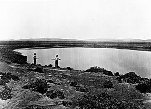
An early study in 1885 described the larger lake. Its rim rose about 24 meters (80 feet) above the desert. It was also about 50 meters (165 feet) higher than the lake's surface. The deepest part of the lake was measured at 45 meters (147 feet).
Why Did the Lake Level Rise?
The water level in Big Soda Lake increased a lot in the early 1900s. This happened after the Lahontan Dam was built on the Carson River between 1911 and 1916. More water was also brought to the area for farming. This caused the underground water level to rise.
The rising groundwater made Big Soda Lake much deeper. Its depth increased by about 18 meters (60 feet). It went from 45 meters (147 feet) to 63 meters (207 feet) deep. This rise in water level stopped the soda businesses. Their machinery ended up under about 11 meters (35 feet) of water. The lake level became stable around 1930.
What is a Meromictic Lake?
Because of the water level rise, Big Soda Lake became a meromictic lake. In this type of lake, the bottom layer of water is denser and saltier. It never mixes with the top layer of water. The deep water is also anoxic, meaning it has no oxygen. This lack of mixing happens all year round.
Scientists studied the lake in 1978. They found that the boundary between the two layers, called the chemocline, was at 18 meters (59 feet) deep in 1933. By 1978, it had dropped to 37.5 meters (123 feet). Later studies in 1983 and 2015 showed the chemocline remained stable around 35 meters (115 feet) deep.
How Did Tufa Form?
The rising lake level also led to the growth of tufa formations. Tufa are special rock structures. They form when minerals from incoming springs mix with lake water and bacteria. In less than 100 years, some of these tufa formations grew to be over 3 meters (10 feet) tall.
Sometimes, when the lake level changes, the tops of the tufa stick out of the water. These tufa formations are very interesting to scientists. Since they know exactly when the lake level rose, they can study how fast tufa grows. This growth rate surprised many researchers.
How Do Roads Connect to the Lakes?
Nevada State Route 723 is a state highway that is about 3.2 kilometers (2 miles) long. It follows part of Soda Lake Road since 1978. The southern end of this road connects to US Route 50. This main highway passes about 2.4 kilometers (1.5 miles) south of Little Soda Lake.
See also
 In Spanish: Lagos Soda para niños
 | Sharif Bey |
 | Hale Woodruff |
 | Richmond Barthé |
 | Purvis Young |


