Lahontan Valley facts for kids
Quick facts for kids Lahontan Valley |
|
|---|---|
| Lahontan Basin | |

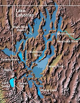
The Lahontan Valley is adjacent to the Carson Sink and southwest of the Humboldt Sink.
|
|
| Floor elevation | 4,006 ft (1,221 m) |
| Geography | |
| Country | United States |
| State | Nevada |
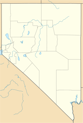
| District | Churchill County |
| Traversed by | U.S. Route 50 |
The Lahontan Valley is a large basin in Churchill County, Nevada, in the United States. This valley was once part of a huge ancient lake called Lake Lahontan. This lake existed between 9,000 and 20,000 years ago.
The Lahontan Valley and the nearby Carson Sink are just a small part of what used to be this massive lakebed. Other lakes like Humboldt Lake, Pyramid Lake, and Walker Lake are also close by. The valley is part of the larger Great Basin Desert. During the California Gold Rush, people often called this area the "Forty Mile Desert."
Contents
What is the Lahontan Valley like?

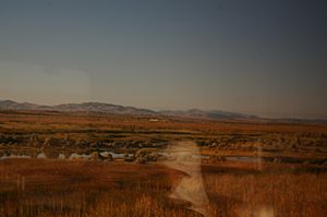
Most of the Lahontan Valley is an empty desert. The main city here is Fallon. There is also the Fallon Paiute-Shoshone Reservation. Some farms exist near the Carson River and its irrigation canals around Fallon. You can also find a few farms near the Soda Lakes volcano.
Other small settlements include the railroad stop at Hazen and the old ghost town of Stillwater. The valley is also home to power plants. These include a geothermal power plant at Soda Lake. Another plant at Stillwater uses both geothermal and solar energy.
The valley gets its name from a French soldier named Louis-Armand de Lom d'Arce de Lahontan, Baron de Lahontan.
The Forty Mile Desert: A Tough Journey
The "Forty Mile Desert" was a name given during the California Gold Rush. It referred to the Lahontan Valley and the area northwest of it. People traveling west on the California Trail would reach the Lahontan Valley. They usually followed the Humboldt River to its end in the Humboldt Sink.
From there, the trail split into two paths. One path went towards the Carson River. The other went towards the Truckee River. No matter which path they chose, travelers faced about 40 miles (64 km) of desert. This stretch had no usable water.
Routes Through the Desert
The Truckee route started near modern Lovelock. It led to the Truckee River near modern Wadsworth. This path went through smaller valleys. These valleys were separated from the main Lahontan Valley by the Hot Springs Mountains. Today, Interstate 80 follows this route very closely.
The Carson route went south from modern Lovelock. It headed towards an area west of modern Fallon. This place was called Ragtown. Ragtown had the last good water from the Carson River. The First transcontinental railroad (now the Overland Route) and U.S. Route 95 generally follow the Carson route.
Challenges of the Forty Mile Desert
A historical marker states that the Forty Mile Desert was the most feared part of the California Trail. Imagine walking 40 miles through deep sand with no water! Many travelers had to walk because their wagon wheels sank. The famous writer Mark Twain described his journey through this desert in 1861. He wrote about how difficult it was.
Twain noted that the road was covered with bones of animals. These animals died trying to cross the desert. He also saw many broken wagons and chains. These items were left behind by desperate travelers. This shows how much hardship the early pioneers faced.
To make the journey easier, people often tried to cross this desert at night. This avoided the extreme heat of the day. In 1850, a survey counted 953 graves along this part of the trail. Thousands of animal skeletons and abandoned belongings were also found. These items were left by travelers who simply could not carry them anymore.
 | Valerie Thomas |
 | Frederick McKinley Jones |
 | George Edward Alcorn Jr. |
 | Thomas Mensah |


