Interstate 80 in Nevada facts for kids
Quick facts for kids
Interstate 80 |
||||
|---|---|---|---|---|
| Dwight D. Eisenhower Highway Purple Heart Trail |
||||
|
Lua error in Module:MapframeForObjects at line 258: attempt to index field 'wikibase' (a nil value).
I-80 highlighted in red
|
||||
| Route information | ||||
| Maintained by NDOT | ||||
| Length | 410.67 mi (660.91 km) | |||
| Existed | June 29, 1956–present | |||
| Major junctions | ||||
| West end | ||||
|
||||
| East end | ||||
| Location | ||||
| Counties: | Washoe, Storey, Lyon, Churchill, Pershing, Humboldt, Lander, Eureka, Elko | |||
| Highway system | ||||
| Main route of the Interstate Highway System Main • Auxiliary • Business Nevada highways
|
||||
Interstate 80 (I-80) is a major highway that crosses the northern part of Nevada. This important road connects many towns and cities across the state. It goes through places like Reno, Fernley, Lovelock, Winnemucca, Battle Mountain, Carlin, Elko, Wells, and West Wendover.
I-80 follows paths that have been used for a long time. These include the historic California Trail, the route of the first transcontinental railroad, and the Feather River Route. It also follows the old Victory Highway, which was later called State Route 1 (SR 1) and US Route 40 (US 40). The highway runs alongside the Truckee and Humboldt rivers. People have used these river paths for travel since the California Gold Rush in the 1840s.
In Nevada, I-80 is also known by two special names: the Dwight D. Eisenhower Highway and the Purple Heart Trail. These names honor important parts of American history.
Contents
Exploring the I-80 Route in Nevada
Traveling Along the Truckee River
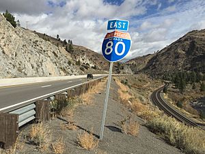
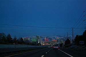
I-80 enters Nevada through a canyon where the Truckee River flows. Here, it runs next to the old California Trail and the first transcontinental railroad. After leaving the canyon, the highway reaches the Truckee Meadows. This area includes the cities of Verdi, Reno, and Sparks.
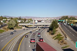
The freeway goes north of downtown Reno. It then meets I-580 and US 395. This meeting point is the busiest part of I-80 in Nevada. It handles over 122,000 vehicles every day! The highway also goes through downtown Sparks on a raised bridge. This bridge even passes over the casino floor of the Nugget Casino Resort.
After leaving the Reno area, I-80 continues to follow the Truckee River through another canyon. It passes by the Northern Nevada Veterans Memorial Cemetery. As the highway moves further east, the number of cars on it drops. It goes from 26,600 vehicles per day near Fernley to only 8,400 in the middle of the state. The highway leaves the Truckee River area near Wadsworth.
Crossing the Lahontan Valley and Forty Mile Desert
After Wadsworth, I-80 crosses the Lahontan Valley. This area is a dry desert, sometimes called the Forty Mile Desert. This name comes from the California Gold Rush. Back then, travelers coming from the Humboldt River had to cross 40 miles (64 km) of this desert without finding any usable water.
I-80 follows almost the same path that those early travelers took between the Humboldt and Truckee rivers. There is a special marker at a rest area on the eastern side of the valley. This marker honors the many travelers who struggled to cross this desert. Thousands of them had to leave behind their belongings, animals, and even loved ones. The marker says this part of the California Trail was the most feared.
Since 2017, the speed limit on I-80 between eastern Fernley and Winnemucca has been raised. It is now 80 miles per hour (129 km/h).
Following the Humboldt River
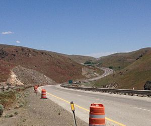
For the next 246 miles (396 km), I-80 follows the Humboldt River. Along this stretch, the highway goes through towns like Lovelock, Winnemucca, Battle Mountain, Carlin, Elko, and Wells. In Winnemucca, I-80 is joined by the Feather River Route railroad. This railroad runs next to I-80 all the way to the Utah state line.
The highway is usually close enough to the river that you can see it. However, in some places, the highway takes shortcuts. It cuts across or tunnels through mountains to avoid big bends in the river. For example, between Winnemucca and Battle Mountain, it goes over Golconda Summit, which is 5,159 feet (1,572 m) high.
The highway also bypasses Palisade Canyon by going over Emigrant Pass, which is 6,114 feet (1,863 m) high. Just east of Carlin, I-80 goes through the Carlin Tunnel. This tunnel helps the highway avoid the sharp curves of the river in Carlin Canyon.
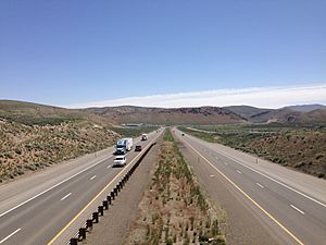
Journey Through Eastern Nevada
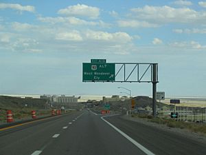
After Wells, I-80 leaves the Humboldt River, the first transcontinental railroad, and the California Trail. From this point eastward, the highway follows other historic paths. These include the Hastings Cutoff, the Feather River Route, and the old US 40 and SR 1.
The highway crosses two mountain ranges before reaching the Great Salt Lake Desert. First, it crosses the Pequop Mountains at Pequop Summit. This is the highest point on I-80 in Nevada, at 6,967 feet (2,124 m) high. Next, it crosses the Toano Range at Silver Zone Pass, which is 5,955 feet (1,815 m) high.
After crossing these mountains, the highway arrives at West Wendover. Here, I-80 enters both Utah and the famous Bonneville Salt Flats of the Great Salt Lake Desert.
Parts of I-80 in Nevada share the road with other US Routes. This means they run together for a while.
- US 95 Alternate (US 95 Alt): This road runs with I-80 between Fernley and Trinity Junction, near Lovelock.
- US 95: This road joins I-80 between Trinity Junction and Winnemucca.
- US 93 Alternate (US 93 Alt): This road shares I-80 between the cities of Wells and West Wendover.
A Look Back: The History of I-80 in Nevada
The California Trail's Influence
The general path of I-80 was first used by people traveling to California. This path was known as the California Trail. From the Utah state line west to the Humboldt River, I-80 follows a slightly changed version of a less-used part of the trail called Hastings Cutoff. This cutoff later joins the main California Trail in the Humboldt River canyon.
From Elko west to Lovelock, I-80 follows the California Trail very closely. West of Lovelock, the California Trail split into two branches. These branches were named after the rivers that guided them up the Sierra Nevada mountains: the Carson River route and the Truckee River route. I-80 follows the Truckee route.
Transcontinental Railroads and Their Paths
The path that I-80 now takes was also used to build two very important railroads. The first transcontinental railroad was finished in 1869. It followed the main California Trail and I-80's path west of Wells. The Feather River Route was built in 1909. It generally followed the Hastings Cutoff through Eastern Nevada. This railroad also runs next to I-80 in Nevada east of Winnemucca.
From Old Highways to I-80
The first paved road across this part of Nevada was the Victory Highway. In Nevada, it was called SR 1. When the United States Numbered Highway System was created, this route became US 40.
Later, with the start of the Interstate Highway System, this highway was slowly improved to meet Interstate standards and became I-80. In 1974, officials decided to shorten the route of US 91. Nevada officials agreed and also suggested shortening US 91 and US 40. These changes happened in 1975. The 1976 Nevada highway map was the first one that did not show the US 40 name.
Even though the US Route name was removed, the freeway was not yet fully completed. The last part of I-80 in Nevada to be finished was the Lovelock bypass. Construction on this section began in 1981. The 1982 Official Nevada Highway Map was the first to show I-80 as a continuous freeway across the entire state. All the local business loop roads for I-80 in Nevada still use the old route of US 40.
I-80 in Nevada is also known as the Dwight D. Eisenhower Highway. This name honors Dwight D. Eisenhower, a former president of the United States. It is also called the Purple Heart Trail, named after the Purple Heart military award.
Future Plans for I-80
There are plans to make I-80 wider in some areas. The idea is to add a third lane in both directions. This widening would happen between Vista Boulevard and Greg Street, all the way to SR 439 south (USA Parkway). This will help with traffic flow in the future.
See also
 In Spanish: Interestatal 80 (Nevada) para niños
 | Frances Mary Albrier |
 | Whitney Young |
 | Muhammad Ali |


