
Sodus (village), New York facts for kids
Quick facts for kids
Sodus, New York
|
|
|---|---|
_highlighted.svg)
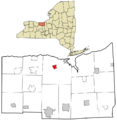
Location in Wayne County and the state of New York.
|
|

Sodus (village), New York
Location in New York
|
|
| Country | United States |
| State | New York |
| County | Wayne |
| Town | Sodus |
| Settled | 1809 |
| Incorporated | December 30, 1917 |
| Named for | "Assorodus," the Cayuga language word for "silvery water" |
| Government | |
| • Type | Board of Trustees |
| Area | |
| • Total | 0.94 sq mi (2.44 km2) |
| • Land | 0.94 sq mi (2.44 km2) |
| • Water | 0.00 sq mi (0.00 km2) |
| Elevation | 432 ft (133 m) |
| Population
(2020)
|
|
| • Total | 1,667 |
| • Density | 1,771.52/sq mi (684.03/km2) |
| Time zone | UTC-5 (EST) |
| • Summer (DST) | UTC-4 (EDT) |
| ZIP Code(s) |
14551
|
| Area code(s) | 315 and 680 |
| FIPS code | 36-68209 |
| GNIS feature ID | 0965619 |
| Website | http://villageofsodus.org/ |
Sodus is a small village in Wayne County, New York, United States. In 2010, about 1,819 people lived there.
The Village of Sodus is located near the middle of the larger Town of Sodus. It sits between the cities of Rochester and Syracuse. The village is also where the local government for the Town of Sodus is located.
Contents
History of Sodus Village
The land where Sodus is now was once part of the Iroquois Confederacy. Specifically, the Onondaga nation lived here for many years. They would set up camps by the lake to fish and hunt in the nearby forests.
After the American Revolution, the Onondaga and most Iroquois tribes had sided with Great Britain. Because Britain lost the war, these tribes had to give up their lands to New York. This was part of a peace agreement called the Treaty of Fort Stanwix. Many tribes, including the Onondaga, then moved to Upper Canada (now part of Ontario). The British government gave them new lands there.
The first European-American settlers arrived in Sodus in 1809. They were part of a large movement of people from New England coming to western New York after the war. The village of Sodus officially became a village in 1917.
Geography of Sodus
Sodus village covers about 0.9 square miles (2.4 square kilometers) of land. There is no water area within the village limits.
The village is located on New York State Route 104, which goes around the northern part of Sodus. It is also the northern end of New York State Route 88. Other roads like County Roads 134 and 143 also lead into the village.
Sodus is located south of the shore of Lake Ontario. It is also southwest of Sodus Bay, a large bay on Lake Ontario.
Population of Sodus
| Historical population | |||
|---|---|---|---|
| Census | Pop. | %± | |
| 1870 | 516 | — | |
| 1880 | 842 | 63.2% | |
| 1890 | 1,028 | 22.1% | |
| 1920 | 1,329 | — | |
| 1930 | 1,444 | 8.7% | |
| 1940 | 1,513 | 4.8% | |
| 1950 | 1,588 | 5.0% | |
| 1960 | 1,645 | 3.6% | |
| 1970 | 1,813 | 10.2% | |
| 1980 | 1,790 | −1.3% | |
| 1990 | 1,904 | 6.4% | |
| 2000 | 1,735 | −8.9% | |
| 2010 | 1,819 | 4.8% | |
| 2020 | 1,667 | −8.4% | |
| U.S. Decennial Census | |||
In 2010, Sodus had 1,819 people living in 710 households. About 29.3% of these households had children under 18. The average household had 2.55 people.
The population included people of different backgrounds. About 75.3% were White, and 15.7% were Black or African American. About 8.4% of the population identified as Hispanic or Latino.
The median age in the village was 36.6 years old. This means half the people were younger than 36.6 and half were older.
Schools in Sodus
The Sodus Central School District has two main buildings. The Sodus Central Elementary School is for students in kindergarten through 5th grade. The other building houses both the Middle School (grades 6-8) and the High School (grades 9-12).
Images for kids
-
Location in Wayne County and New York State.
See also
 In Spanish: Sodus (villa) para niños
