Somonauk, Illinois facts for kids
Quick facts for kids
Somonauk
|
|
|---|---|

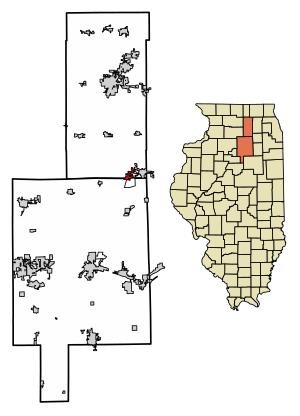
Location of Somonauk in DeKalb County, Illinois.
|
|

Location of Illinois in the United States
|
|
| Country | United States |
| State | Illinois |
| Counties | DeKalb, LaSalle |
| Townships | Somonauk, Northville |
| Settled | 1834 |
| Incorporated (village) | February 16, 1865 |
| Area | |
| • Total | 2.49 sq mi (6.46 km2) |
| • Land | 2.49 sq mi (6.44 km2) |
| • Water | 0.01 sq mi (0.02 km2) |
| Elevation | 686 ft (209 m) |
| Population
(2020)
|
|
| • Total | 1,786 |
| • Density | 717.85/sq mi (277.22/km2) |
| Time zone | UTC-6 (CST) |
| • Summer (DST) | UTC-5 (CDT) |
| ZIP Code(s) |
60552
|
| Area codes | 815 & 779 |
| FIPS code | 17-70460 |
| GNIS feature ID | 2399838 |
Somonauk is a small village located in Illinois, a state in the United States. It sits across two counties: DeKalb and LaSalle. In 2020, about 1,786 people lived there.
Most of Somonauk, the part in DeKalb County, is considered part of the larger Chicago-Naperville-Elgin, IL-IN-WI Metropolitan Statistical Area. This means it's connected to the big city area around Chicago. The smaller part in LaSalle County is near Ottawa.
Contents
Early History of Somonauk
The name "Somonauk" comes from the Potawatomi Native American people. It likely means "pawpaw grove." Pawpaws are a type of fruit tree that grew a lot in this area long ago.
Treaties and Early Settlements
In 1829, a treaty was signed that set aside land for Chief Awn-kote and his Potawatomi group. This land was near the Fox and Illinois Rivers. The Potawatomi, along with other tribes, helped the U.S. in the Black Hawk War. After the war, they were allowed to hunt on U.S. land.
However, white settlers became worried about the Potawatomi. By the end of 1833, the Potawatomi had left Illinois. This opened up the land for new settlers.
Moving the Village Name
In 1834, the first white settler arrived in DeKalb County. They set up a cabin near the Fox River. This cabin became a stop for mail carriers on the route between Chicago and Galena. This area was first called "Somonauk." It's known today as "Franks."
This cabin also became the first post office in the area. About 30 settlers lived there, and they built a church and a school. It's believed that this church was a stop on the Underground Railroad, a secret network that helped enslaved people find freedom.
Later, the post office moved several times. In 1853, a railroad station was built about 5 miles south of the original settlement. The name "Somonauk" then moved to this new location, where the village is today. It officially became a village in 1865.
Geography of Somonauk
Somonauk is located at 41°37′58″N 88°41′11″W / 41.63278°N 88.68639°W. It sits right on the line between DeKalb and LaSalle counties. Most of the village's residents live in DeKalb County.
The village covers about 2.49 square miles (6.46 square kilometers). Most of this area is land, with a very small amount of water.
Natural Areas and Lakes
The Sannauk Forest Preserve is a natural area near Somonauk. It's owned by DeKalb County and is located along Somonauk Creek. This creek flows into the Fox River.
Near Somonauk is Lake Holiday. This is a man-made lake. It was created by building a dam on Somonauk Creek. An old gravel pit was also flooded to become part of the lake.
Population and People
| Historical population | |||
|---|---|---|---|
| Census | Pop. | %± | |
| 1880 | 587 | — | |
| 1890 | 468 | −20.3% | |
| 1900 | 630 | 34.6% | |
| 1910 | 591 | −6.2% | |
| 1920 | 540 | −8.6% | |
| 1930 | 578 | 7.0% | |
| 1940 | 610 | 5.5% | |
| 1950 | 721 | 18.2% | |
| 1960 | 899 | 24.7% | |
| 1970 | 1,112 | 23.7% | |
| 1980 | 1,344 | 20.9% | |
| 1990 | 1,263 | −6.0% | |
| 2000 | 1,295 | 2.5% | |
| 2010 | 1,893 | 46.2% | |
| 2020 | 1,786 | −5.7% | |
| U.S. Decennial Census | |||
In 2020, Somonauk had 1,786 residents living in 721 households. About 518 of these were families.
Most people in the village are White. A small percentage are from other racial backgrounds or have mixed heritage. About 6.55% of the population is Hispanic or Latino.
About 34% of households in Somonauk had children under 18 living with them. Many households (59.5%) were married couples. The average household had about 3 people.
The median age in Somonauk was 37.8 years old. This means half the people were younger than 37.8, and half were older.
The median income for a household in Somonauk was $71,375. This means half the households earned more than this amount, and half earned less. About 7.7% of the total population lived below the poverty line.
Education in Somonauk
Children in Somonauk attend schools in the Somonauk Community Unit School District (CUSD) #432. This district serves students from Pre-Kindergarten all the way through 12th grade.
The school's sports teams are called the Bobcats. Their colors are blue and gold. The school song, "Bobcat Loyalty," is based on the University of Illinois' fight song.
The school district also covers parts of the nearby private community called "Lake Holiday." However, another school district, Sandwich Community Unit School District 430, covers other parts of Lake Holiday.
See also
 In Spanish: Somonauk para niños

