South Branch Ashuelot River facts for kids
Quick facts for kids South Branch Ashuelot River |
|
|---|---|

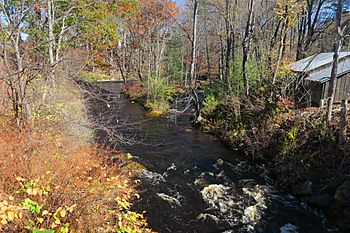
The South Branch in East Swanzey
|
|
| Country | United States |
| State | New Hampshire |
| County | Cheshire |
| Towns | Troy, Marlborough, Swanzey |
| Physical characteristics | |
| Main source | Confluence of Rockwood Brook and Quarry Brook Troy 955 ft (291 m) 42°49′39″N 72°10′42″W / 42.82750°N 72.17833°W |
| River mouth | Ashuelot River Swanzey 463 ft (141 m) 42°53′21″N 72°16′57″W / 42.88917°N 72.28250°W |
| Length | 17.4 mi (28.0 km) |
| Basin features | |
| Tributaries |
|
The South Branch of the Ashuelot River is a cool river in southwestern New Hampshire, United States. It's about 17.4-mile-long (28.0 km), which is like running a half-marathon! This river is a smaller part, or tributary, of the larger Ashuelot River.
The Ashuelot River then flows into the even bigger Connecticut River. Finally, the Connecticut River empties into Long Island Sound. So, the South Branch is part of a long chain of waterways!
Contents
Where Does the River Start?
The South Branch Ashuelot River begins in the town of Troy, New Hampshire. It forms when two smaller streams, Rockwood Brook and Quarry Brook, meet up. Imagine two small trickles joining to become a bigger flow!
The River's Journey
From its start, the river takes an interesting, zigzag path. It first flows northwest, then turns southwest, and finally heads north. It keeps going until it reaches the main Ashuelot River in Swanzey.
Through the Mountains
In its first part, flowing northwest, the river drops very quickly. It carves a deep, narrow valley through the highlands near Troy and Marlborough. It's like the river is cutting its own path through the hills!
You can even see New Hampshire Route 12 and an old, unused railroad line following the river here. They stick close to the river as it rushes down.
Wider Valleys and Zigzags
When the river turns southwest, the valley gets wider. This makes more space around the river. There's just one small part where the valley narrows again, as the river passes by the village of East Swanzey.
The very last part of the river's journey is a north-flowing section. Here, the river moves through a wide, flat area. It makes many tight bends and loops, called meanders, as it slowly winds its way to meet the Ashuelot River.
 | William M. Jackson |
 | Juan E. Gilbert |
 | Neil deGrasse Tyson |


