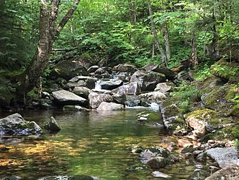
South Branch Gale River facts for kids
Quick facts for kids South Branch Gale River |
|
|---|---|

The South Branch, south of the Gale River Loop Road
|
|
| Country | United States |
| State | New Hampshire |
| County | Grafton |
| Towns | Franconia, Bethlehem |
| Physical characteristics | |
| Main source | Mount Lafayette Franconia 3,640 ft (1,110 m) 44°10′32″N 71°38′54″W / 44.17556°N 71.64833°W |
| River mouth | Gale River Bethlehem 1,310 ft (400 m) 44°14′37″N 71°38′17″W / 44.24361°N 71.63806°W |
| Length | 5.1 mi (8.2 km) |
| Basin features | |
| Tributaries |
|
The South Branch of the Gale River is a small river in the White Mountains of New Hampshire, United States. It flows for about 5.1 miles (8.2 kilometers). This river is part of a larger water system. Its waters eventually join the Connecticut River.
Contents
About the South Branch Gale River
The South Branch Gale River is an important part of the local environment. It helps to feed other rivers in the area. The river is known for its clear, fresh water.
Where the River Starts
The South Branch begins high up on the north side of Mount Lafayette. This mountain is located in the town of Franconia, New Hampshire. The river starts near a place called Garfield Ridge.
The River's Journey
From its source, the South Branch flows quickly downhill. It moves north through the landscape. The river then meets up with the North Branch. Together, they form the main Gale River. This meeting point is near U.S. Route 3.
Important Uses of the River
The South Branch of the Gale River is very useful to people. It provides clean drinking water for the town of Bethlehem, New Hampshire. This makes it a vital natural resource for the community.
 | Claudette Colvin |
 | Myrlie Evers-Williams |
 | Alberta Odell Jones |


