Mount Lafayette facts for kids
Quick facts for kids Mount Lafayette |
|
|---|---|

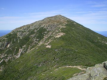
Mount Lafayette as viewed from Franconia Ridge. Hikers are visible hiking through the krummholz in the col.
|
|
| Highest point | |
| Elevation | 5,249 ft (1,600 m) NAVD 88 |
| Prominence | 3,320 ft (1,010 m) |
| Parent peak | Mount Monroe |
| Listing | White Mountain 4000-footers; #4 New England Fifty Finest |
| Geography | |
| Country | United States |
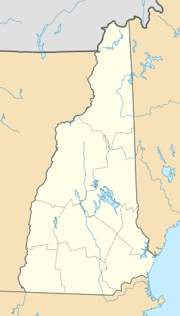
| State | New Hampshire |
| District | Grafton County |
| Parent range | Franconia Range |
| Subdivisions | Franconia |
| Topo map | USGS Franconia |
| Climbing | |
| Easiest route | Hike from trailheads directly off Interstate 93 |
Mount Lafayette is a tall mountain in the White Mountains of New Hampshire, United States. It stands at 5,249-foot (1,600 m) high. This impressive peak is at the northern end of the Franconia Range.
Mount Lafayette is located in the town of Franconia. It is also part of Grafton County. The mountain is known for its height and is listed among the New England Fifty Finest peaks. This means it is one of the most prominent mountains in New England.
The very top parts of Mount Lafayette are in what's called the alpine zone. This is a special area where only small plants can grow. The weather here is very harsh and cold.
Exploring Mount Lafayette
Mount Lafayette is the highest point in the Franconia Range. This range is a line of peaks found along the east side of Franconia Notch. It is the sixth highest peak in New Hampshire. It is also the tallest mountain outside of the Presidential Range.
A large part of the mountain is within the White Mountain National Forest. Its western slopes are inside Franconia Notch State Park. The very top of the mountain marks the western edge of the Pemigewasset Wilderness Area. This is a special protected area within the forest.
Hiking Trails to the Summit
Many trails lead up Mount Lafayette. They climb over 3,000 feet (900 meters) to its open top.
- The Greenleaf Trail starts near the Cannon Mountain tramway. It goes up to the Appalachian Mountain Club's Greenleaf Hut. From there, it continues to the summit.
- The Bridle Path trail also leads to the summit. It starts from Lafayette Place Campground on Interstate 93. This trail passes Greenleaf Hut and then joins the Greenleaf Trail. It reaches the top about 1.1 miles (1.8 km) after the hut.
The summit of Mount Lafayette is an important meeting point for trails. The Garfield Ridge Trail goes northeast to Mount Garfield. The Franconia Ridge Trail heads south to Mount Lincoln, Mount Liberty, and Mount Flume. Both the Garfield Ridge Trail and the Franconia Ridge Trail are part of the famous Appalachian Trail.

A very popular hike is a loop that includes three main peaks of the Franconia Range. This loop starts with the Old Bridle Path to the AMC Greenleaf Hut. From the hut, hikers take the Greenleaf Trail to the top of Mount Lafayette. Then, they turn south along the Franconia Ridge Trail. This path goes over Mount Lincoln and Little Haystack. Finally, hikers go down using the Falling Waters Trail. This trail connects back to the start of the Old Bridle Path. This entire loop is about 8.9 miles (14.3 km) long. It involves climbing about 3,900 feet (1,200 m) in total.
History of the Mountain's Name

Mount Lafayette is named after General Lafayette. He was a French military hero. General Lafayette helped the Continental Army a lot during the American Revolutionary War. He became a close friend and helper to George Washington.
In 1824-1825, Lafayette made a special trip back to the United States. He visited New Hampshire and all the other states at that time. This trip celebrated the 50th anniversary of the Battle of Bunker Hill. The mountain was named in his honor to remember his important contributions.
 | Emma Amos |
 | Edward Mitchell Bannister |
 | Larry D. Alexander |
 | Ernie Barnes |


