South Branch Mountain facts for kids
Quick facts for kids South Branch Mountain |
|
|---|---|

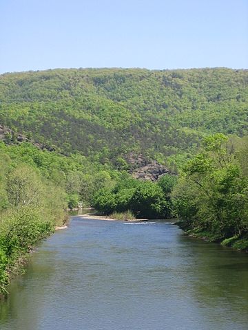
South Branch Mountain viewed at its northern end from Millesons Mill, West Virginia.
|
|
| Highest point | |
| Elevation | 3,028 ft (923 m) |
| Geography | |
| Location | Hampshire / Hardy counties, West Virginia, U.S. |
| Parent range | Ridge-and-Valley Appalachians |
| Topo map | USGS Sector, Springfield |
| Climbing | |
| Easiest route | Drive |
South Branch Mountain is a long mountain ridge in West Virginia, USA. It stretches through Hampshire and Hardy counties. This mountain is part of the Eastern Panhandle region.
The highest point of South Branch Mountain is 3,028 feet (923 meters) above sea level. This high point is found within the Nathaniel Mountain Wildlife Management Area. It is one of the biggest and most noticeable mountains in the Ridge-and-Valley Appalachians.
South Branch Mountain forms the eastern edge of the South Branch Potomac River Valley. It runs alongside the river from Springfield to Moorefield. Early settlers in the 1700s first called it Jersey Mountain.
Roads and the Mountain
An important road called the Northwestern Turnpike (U.S. Route 50) crosses South Branch Mountain. This happens between the towns of Shanks and Romney. This area is known as Sunrise Summit.
Years ago, there were wet, forested areas at the top of the mountain here. However, new buildings and businesses along US 50 have changed these natural spaces.
Further south, near Moorefield, another big road project called Corridor H was built. This construction has also affected South Branch Mountain. It has changed the mountain's forests, the homes of animals, and the natural shape of the land.
 | DeHart Hubbard |
 | Wilma Rudolph |
 | Jesse Owens |
 | Jackie Joyner-Kersee |
 | Major Taylor |

