
South Run, Virginia facts for kids
Quick facts for kids
South Run, Virginia
|
|
|---|---|

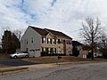
Houses in South Run CDP, January 2018
|
|

South Run, Virginia
Location in Northern Virginia

South Run, Virginia
Location in Virginia

South Run, Virginia
Location in the United States
|
|
| Country | |
| State | |
| County | |
| Area | |
| • Total | 2.60 sq mi (6.73 km2) |
| • Land | 2.53 sq mi (6.56 km2) |
| • Water | 0.07 sq mi (0.17 km2) |
| Elevation | 300 ft (90 m) |
| Population
(2020)
|
|
| • Total | 6,462 |
| • Density | 2,521/sq mi (973.2/km2) |
| Time zone | UTC−5 (Eastern (EST)) |
| • Summer (DST) | UTC−4 (EDT) |
| ZIP codes |
22039, 22153
|
| FIPS code | 51-74120 |
| GNIS feature ID | 2584922 |
South Run is a special community in Fairfax County, Virginia, in the United States. It's called a census-designated place because it's a specific area the government counts for population. In 2020, about 6,462 people lived there.
Contents
Exploring South Run's Location
South Run is located in the southern part of Fairfax County. It has several neighbors around it. To the northwest, you'll find Burke Lake Park, a great place for outdoor activities.
Neighboring Communities
To the north of South Run is the community of Burke. East of South Run is Newington Forest. To the south, you'll find Crosspointe.
How South Run is Bordered
The community's edges are marked by several roads and natural features. The Fairfax County Parkway (Virginia Route 286) forms the northern border. Hooes Road is on the east side. To the south, the borders are formed by South Run (a small stream), a part of its tributary, and Silverbrook Road. Ox Road (Virginia State Route 123) marks the southwest border.
Distance to Nearby Cities
The city of Fairfax is about 8 miles (13 km) north of South Run. If you travel northeast for about 20 miles (32 km), you will reach downtown Washington, D.C..
Land and Water in South Run
The total area of South Run is about 2.6 square miles (6.73 square kilometers). Most of this area is land. About 2.5 square miles (6.56 square kilometers) is land.
Water Features
A small part of South Run, about 0.06 square miles (0.17 square kilometers), is water. This means about 2.52% of the area is water. The South Run stream flows through the middle of the community from west to east.
Lake Mercer and Local Streams
The South Run stream is a smaller stream that flows into Pohick Creek. Pohick Creek is part of the larger Potomac River system. At the southeast corner of South Run, the stream forms a lake called Lake Mercer.
Images for kids
-
Houses in South Run CDP, January 2018
See also
 In Spanish: South Run (Virginia) para niños
