South Sioux City, Nebraska facts for kids
Quick facts for kids
South Sioux City
|
|
|---|---|

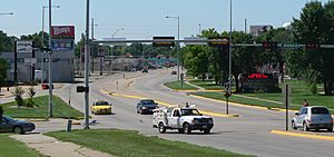
Heading south on Dakota Avenue approaching Riverview Drive, July 2010
|
|

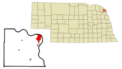
Location of South Sioux City within Nebraska and Dakota County
|
|
| Country | United States |
| State | Nebraska |
| County | Dakota |
| Incorporated | 1887 |
| Area | |
| • Total | 6.63 sq mi (17.16 km2) |
| • Land | 6.30 sq mi (16.32 km2) |
| • Water | 0.33 sq mi (0.85 km2) |
| Elevation | 1,099 ft (335 m) |
| Population
(2020)
|
|
| • Total | 14,043 |
| • Density | 2,229.40/sq mi (860.74/km2) |
| Time zone | UTC−6 (Central (CST)) |
| • Summer (DST) | UTC−5 (CDT) |
| ZIP code |
68776
|
| Area code(s) | 402 |
| FIPS code | 31-46030 |
| GNIS feature ID | 2395919 |
| Website | http://www.southsiouxcity.org/ |
South Sioux City is a city in Dakota County, Nebraska, United States. It is located right across the Missouri River from Sioux City, Iowa. This city is part of the larger Sioux City area, which includes parts of Iowa, Nebraska, and South Dakota. In 2020, about 14,043 people lived here. This makes it the 14th largest city in Nebraska.
Contents
History of South Sioux City
Early Explorers and Settlements
The famous explorers Meriwether Lewis and William Clark traveled through the South Sioux City area in 1804. This was during their big journey across the western United States.
European settlers started building homes on the Nebraska side of the river around 1854. Several small towns were planned and officially started in the 1850s. One of these was Pacific City, which began in 1858 but did not last long.
Two other towns, Covington and South Covington, were started in 1857. They later joined together in 1870. Another town called Stanton was founded in 1856.
Becoming a City
South Sioux City officially became a city in 1887. Later, in 1893, the towns of Covington and Stanton decided to merge with South Sioux City. This helped the city grow bigger and stronger.
Geography and Landscape
City Area and Waterways
South Sioux City covers an area of about 5.96 square miles (15.44 square kilometers). Most of this area, about 5.71 square miles (14.79 square kilometers), is land. The rest, about 0.25 square miles (0.65 square kilometers), is water. This water includes parts of the Missouri River.
Elevation and Terrain
Unlike its neighbor, Sioux City, which has many hills, South Sioux City is mostly flat. The land height across most of the city changes by less than 20 feet. It is usually between 1,085 and 1,105 feet above sea level. This means it is a fairly level place to live and build.
Population and People
| Historical population | |||
|---|---|---|---|
| Census | Pop. | %± | |
| 1890 | 603 | — | |
| 1900 | 889 | 47.4% | |
| 1910 | 1,196 | 34.5% | |
| 1920 | 2,402 | 100.8% | |
| 1930 | 3,927 | 63.5% | |
| 1940 | 4,556 | 16.0% | |
| 1950 | 5,557 | 22.0% | |
| 1960 | 7,200 | 29.6% | |
| 1970 | 7,920 | 10.0% | |
| 1980 | 9,339 | 17.9% | |
| 1990 | 9,677 | 3.6% | |
| 2000 | 11,925 | 23.2% | |
| 2010 | 13,353 | 12.0% | |
| 2020 | 14,043 | 5.2% | |
| U.S. Decennial Census | |||
Population Changes Over Time
The population of South Sioux City has grown a lot over the years. In 1890, only 603 people lived there. By 2020, the population had grown to 14,043 people. This shows how the city has developed and attracted more residents.
Who Lives in South Sioux City?
In 2010, there were 13,353 people living in South Sioux City. The city is home to a diverse group of people. Many different backgrounds and cultures are represented here. About 45.3% of the population identified as Hispanic or Latino.
Many households in the city have children under 18 living with them. The average household had about 2.93 people. The average family had about 3.51 people. The median age in the city was 30.5 years old. This means half the people were younger and half were older than 30.5.
Arts and Culture
Local Events and Entertainment
South Sioux City hosts an Annual Art Show every April. This event brings together artists from all over the United States. It is a great chance to see different kinds of art.
For many years, horse racing was a popular activity at Atokad Downs. This track was a place where people could watch exciting horse races for 58 years.
Transportation and Infrastructure
Major Highways Connecting the City
Several important highways serve South Sioux City, making it easy to travel to and from the city.
- Interstate 129 is a short highway that connects to Interstate 29 in Sioux City. It crosses the Missouri River into South Sioux City. This highway also overlaps with U.S. routes 20 and 75.
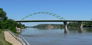
- U.S. Route 77 is a north-south highway. It enters South Sioux City using the Siouxland Veterans Memorial Bridge. It then follows Dakota Avenue, which is the city's main street, before curving around the city as a four-lane bypass.
Public Transportation
Local bus services are available in South Sioux City. These services are provided by the Sioux City Transit System. This helps people get around the city without needing a car.
Air Travel Options
For commercial flights, the closest airport is Sioux Gateway Airport/Colonel Bud Day Field (SUX) in Sioux City. There is also a smaller airport for general aviation called Martin Field (7K8). It is located just west of South Sioux City.
See also
 In Spanish: South Sioux City (Nebraska) para niños
 | Leon Lynch |
 | Milton P. Webster |
 | Ferdinand Smith |


