Southwest LRT Trail facts for kids
Quick facts for kids Southwest LRT Trail |
|
|---|---|

Minnesota River Bluffs LRT Regional Trail in Eden Prairie
|
|
| Location | Minnesota, United States |
| Use | Cycling, pedestrians |
| Cycling details | |
| Trail difficulty | Easy |
| Surface | Paved; crushed limestone |
The Southwest LRT Trail is a cool network of paths where you can bike or walk! It stretches through many towns west of Minneapolis. The Three Rivers Park District takes care of these trails.
These paths used to be old railway lines, built by the Minneapolis and St. Louis Railway. Now, they've been turned into trails for everyone to enjoy. They were changed because a new light rail train project, called the Southwest Corridor, is being built. These old railway lines are now split into three different trails.
Contents
Explore the Southwest LRT Trails
Cedar Lake LRT Regional Trail
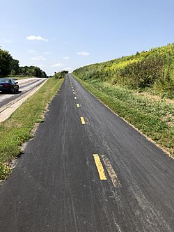
The Cedar Lake LRT Regional Trail is a main paved path. It starts in Minneapolis at the end of the Midtown Greenway. From there, it goes through St. Louis Park and ends in Hopkins.
This trail is about 5.38 miles (8.66 km) long and is paved with asphalt. It has a similar name to the Cedar Lake Trail and the North Cedar Lake Regional Trail. These other trails also go through St. Louis Park to Hopkins, running somewhat parallel to this one.
The Cedar Lake LRT Regional Trail follows an old railway line. This line was built way back in 1870! The Chicago and North Western Railway later owned it, but they stopped using it in 1990. Currently, the Cedar Lake LRT trail is temporarily closed for the Southwest LRT project. But don't worry, the North Cedar Lake trail is still open!
Minnesota River Bluffs LRT Regional Trail

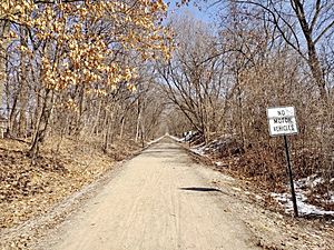
The Minnesota River Bluffs LRT Regional Trail is a trail that stretches for about 12.26 miles (19.73 km). It also follows an old Minneapolis and St. Louis railway line that went to Hopkins. This trail has a surface made of crushed limestone.
It starts at the Hopkins Depot and goes through Hopkins, Minnetonka, Eden Prairie, and Chanhassen. If you combine the Cedar Lake LRT Trail and this one, they are about 15.5 miles (24.9 km) long!
Part of this trail has been closed since 2014 due to mudslides. There is a detour posted to help you find your way around. The trail is very popular, with about 250,000 people visiting it every year. Along the trail, you can see the beautiful bluffs of the Minnesota River, as well as lakes and forests.
There's a cool pedestrian bridge on the trail that crosses Valley View Road. It replaced an old 19-foot (5.8 m) railway bridge. People used to call the old one the "Graffiti Bridge." It was even shown in a 1990 movie by the musician Prince! The old bridge was taken down in 1991.
The new Southwest LRT light rail line will follow the entire Cedar Lake LRT Regional Trail. It will also use part of the Minnesota River Bluffs LRT Regional Trail. Then, it will turn south near Shady Oak Road in Minnetonka.
Lake Minnetonka LRT Regional Trail

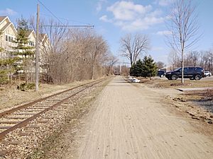
The Lake Minnetonka LRT Regional Trail is about 15.92 miles (25.62 km) long. It starts at 8th Avenue in Hopkins. Then it goes through Minnetonka, Excelsior, and Chanhassen. It ends at 81st Street in Victoria. This trail also has a crushed limestone surface.
It connects to the Minnesota River Bluffs LRT trail through "The Artery" along 8th Avenue South in Hopkins. This connection opened in 2018. This trail also uses an old railway line. It was built by the Minneapolis and St. Louis in the 1890s. The Chicago and North Western stopped using it in 1980.
About 471,000 people use this trail each year. Along the trail, you can see Lake Minnetonka. You can also find restaurants in Hopkins and Excelsior. There are even historic places like the Old Log Theatre and the Cottagewood General Store nearby!
 | Jessica Watkins |
 | Robert Henry Lawrence Jr. |
 | Mae Jemison |
 | Sian Proctor |
 | Guion Bluford |

