Spanish Fork (river) facts for kids
Quick facts for kids Spanish Fork |
|
|---|---|
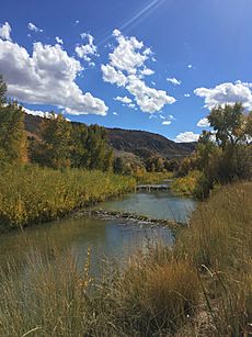
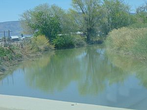
Fall leaves along the Spanish Fork River
|
|
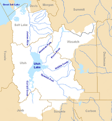
Map of the Jordan River watershed, which includes the Spanish Fork
|
|
| Country | United States |
| State | Utah |
| County | Utah County |
| Physical characteristics | |
| Main source | Confluence of the Soldier and Thistle creeks Spanish Fork Canyon 39°59′41″N 111°29′55″W / 39.99472°N 111.49861°W |
| River mouth | Utah Lake Provo Bay 4,495 ft (1,370 m) 40°10′03″N 111°44′42″W / 40.16750°N 111.74500°W |
| Length | 20 mi (32 km) |
| Basin features | |
| Basin size | 675 sq mi (1,750 km2) |
| Tributaries |
|
The Spanish Fork is a river located in Utah County, Utah, in the United States. It is also often called the Spanish Fork River. This river is important for the local area, especially for farming.
Contents
What is the Spanish Fork River?
The Spanish Fork River starts in Spanish Fork Canyon. It is formed when two smaller streams, Soldier Creek and Thistle Creek, join together. This happens near the old town of Thistle, which is in the Wasatch Range mountains.
Soon after it begins, another stream called Diamond Fork joins the river. The Spanish Fork River then flows about 20 miles (32 km) to the northwest. It leaves the canyon and flows into Utah Lake. Along its way, the river passes through the city of Spanish Fork. It also flows near the communities of Benjamin, Lake Shore, and Palmyra.
How is the Spanish Fork River Used?
The Spanish Fork River is used a lot for irrigation. Irrigation means moving water to help crops grow. The area around Spanish Fork has been farmed for a long time, since the 1860s. As more farms were started, the river alone did not have enough water. This was especially true in years with less rain or snow.
To help with this, a special project was completed in 1909. The U.S. Bureau of Reclamation built a tunnel to bring more water to the Spanish Fork. This extra water comes from the Strawberry River. It is part of a bigger project called the Central Utah Project. This added water flows into the Spanish Fork through its main side stream, the Diamond Fork.
Explore the Spanish Fork River Trail
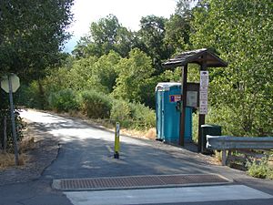
There is a paved trail along the Spanish Fork River. It is about 7 miles (11 km) long. This trail is for people who want to walk, run, or bike. It starts near the entrance of Spanish Fork Canyon. The trail mostly follows the north side of the river. It ends near the western edge of Spanish Fork city.
This trail connects to other trails in the city. One of these is the short Dripping Rock trail. It is about 0.5 miles (0.8 km) long. This trail follows the river south from The Oaks at Spanish Fork golf course.
The Thistle Landslide and the River
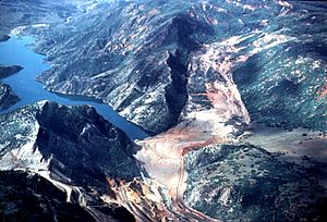
In April 1983, a very large landslide happened near the source of the river in Thistle. This landslide blocked the river completely. The blockage was about 220 feet (67 meters) high. A large lake, called Thistle Lake, formed behind this natural dam. This lake was about 3 miles (5 km) long.
The lake covered the town of Thistle. It also covered parts of two highways, U.S. Route 6 and U.S. Route 89. Railroad tracks in the canyon were also flooded. People thought about making the landslide dam permanent. But it was not safe because the ground was unstable.
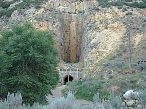
The lake lasted for five months. Then, a special tunnel was built to drain the water. This tunnel goes through the solid rock of the canyon wall. It is north of where the landslide happened. The river still flows through this main bypass tunnel today. The original path of the river could not be recovered.
This landslide was a very big event for Utah. It was the first time a president declared a disaster area for the state. It is also one of the most expensive landslides in U.S. history.
 | Toni Morrison |
 | Barack Obama |
 | Martin Luther King Jr. |
 | Ralph Bunche |


