Spring Creek (White Deer Hole Creek tributary) facts for kids
Quick facts for kids Spring Creek |
|
|---|---|

Spring Creek
|
|
| Physical characteristics | |
| Main source | base of North White Deer Ridge in Washington Township, Lycoming County, Pennsylvania 747 ft (228 m) |
| River mouth | White Deer Hole Creek in Gregg Township, Union County, Pennsylvania near Spring Garden 466 ft (142 m) 41°06′45″N 76°56′03″W / 41.11256°N 76.93412°W |
| Length | 8.2 mi (13.2 km) |
| Basin features | |
| Progression | White Deer Hole Creek → West Branch Susquehanna River → Susquehanna River → Chesapeake Bay |
| Basin size | 21.1 sq mi (55 km2) |
| Tributaries |
|
Spring Creek is a small stream, also called a tributary, that flows into White Deer Hole Creek. It runs through parts of Lycoming County and Union County in Pennsylvania, United States. The creek is about 8.2 miles (13.2 km) long.
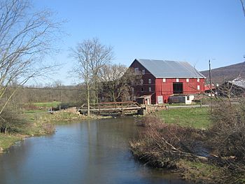
Spring Creek starts in Washington Township in Lycoming County and ends in Gregg Township in Union County. The land area that drains water into Spring Creek, called its watershed, is about 21.1 square miles (55 km2). This creek is known for being clean and healthy. People settled near Spring Creek as early as 1787. A mill was built on the creek in 1842. Many bridges have also been built over it. The creek's watershed is a great place for fishing, especially for trout, and it's also important for migrating fish.
Contents
Where Does Spring Creek Flow?
Spring Creek begins at the bottom of North White Deer Ridge in Washington Township, Lycoming County. It flows southeast for a short distance. Then, it turns to the east-northeast. Along this path, it crosses Pennsylvania Route 554. Here, two small streams, called unnamed tributaries, join it from the left side.
The creek then slowly turns southeast. Two more unnamed streams join it from the left. It also flows through a small pond. After that, a very short stream joins it from the right. Spring Creek then turns east-northeast again. A bit further, another unnamed stream joins from the left.
For a few miles, the creek mostly flows south-southeast. During this part of its journey, two more unnamed streams join from the left, and two join from the right. The creek then turns east for a short distance. It leaves Washington Township and Lycoming County, entering Gregg Township in Union County.
In Union County, Spring Creek winds its way east-southeast for a few miles. Two more unnamed streams join it from the left, and two from the right. Finally, it crosses Pennsylvania Route 44. Soon after, Spring Creek meets and joins White Deer Hole Creek. Spring Creek joins White Deer Hole Creek about 3.59 miles (5.78 km) before White Deer Hole Creek reaches its own end.
How Clean is Spring Creek's Water?
Spring Creek is considered a very healthy stream. It is not listed as an "impaired waterbody." This means its water quality is good and it meets environmental standards. The area around Spring Creek is a special focus for the USDA and the NRCS in Lycoming County. They work to keep the watershed healthy.
What is the Land Like Around Spring Creek?
The land around Spring Creek changes in height. Where Spring Creek meets White Deer Hole Creek, its elevation is about 466 feet (142 m) above sea level. This is the lowest point of the creek. Where Spring Creek begins, its source, the elevation is higher, about 747 feet (228 m) above sea level.
The entire area that collects water for Spring Creek, its drainage basin, covers about 21.1 square miles (55 km2). The mouth of the creek is shown on a map called the Allenwood quadrangle. However, the source of the creek is on the Williamsport quadrangle map. The stream also flows through the Montoursville South quadrangle. The end of Spring Creek is less than 1 mile (1.6 km) from a place called Spring Garden.
A Look Back at Spring Creek's History
Spring Creek was officially added to the Geographic Names Information System on August 2, 1979. This system keeps track of names and locations of places in the United States.
Long ago, Native American paths followed Spring Creek. These paths went from the creek's mouth all the way to its source. From there, they crossed Bald Eagle Mountain to Lycoming Creek and beyond. In 1787, some of the first European settler families in the White Deer Hole Valley lived along Spring Creek. Jesse Weeks had a cabin about 4 miles (6.4 km) upstream from the creek's mouth. Another settler, Daniel Sunderland, lived about 1 mile (1.6 km) upstream from Weeks.
Over time, more buildings appeared. Isaac Hains built one of the first mills in Washington Township on Spring Creek. A church, the Spring Creek church, was also started near the creek on Mill Road in 1877.
Many bridges have been built over Spring Creek to help people travel. For example, a concrete bridge was built in 1919 in Gregg Township. It carries a road called T-528 and is 44.0 feet (13.4 m) long. A newer bridge, built in 2007, carries Pennsylvania Route 44 over the creek. It is 94.2 feet (28.7 m) long. Other bridges, like those carrying State Route 2003 and State Route 2001, were built in 1915 and 1959, respectively. Some of these bridges have also been repaired to keep them safe for travel.
What Animals Live in Spring Creek?
Spring Creek is a great place for fish! Its drainage basin is known as a Trout Stocked Fishery. This means that trout are regularly added to the creek, making it a good spot for fishing. It's also called a Migratory Fishery, which means it's important for fish that travel between different waters. People have said that Spring Creek offers "excellent" chances for fishing.
 | Stephanie Wilson |
 | Charles Bolden |
 | Ronald McNair |
 | Frederick D. Gregory |


