Spring Run (West Branch Susquehanna River tributary) facts for kids
Quick facts for kids Spring Run |
|
|---|---|

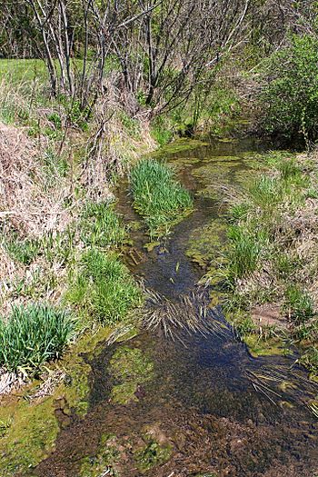
Spring Run looking upstream
|
|
| Other name(s) | The Gut |
| Physical characteristics | |
| Main source | shallow valley in Delaware Township, Northumberland County, Pennsylvania 551 ft (168 m) |
| River mouth | West Branch Susquehanna River in Watsontown, Northumberland County, Pennsylvania 449 ft (137 m) 41°05′18″N 76°52′28″W / 41.08830°N 76.87449°W |
| Length | 2.3 mi (3.7 km) |
| Basin features | |
| Progression | West Branch Susquehanna River → Susquehanna River → Chesapeake Bay |
| Basin size | 1.34 sq mi (3.5 km2) |
Spring Run, also known as "The Gut," is a small stream that flows into a bigger river called the West Branch Susquehanna River. You can find it in Northumberland County, Pennsylvania, USA. It's about 2.3 miles (3.7 km) long and winds its way through Delaware Township and the town of Watsontown. The area of land that drains water into Spring Run, called its watershed, is about 1.34 square miles (3.5 km2).
Scientists have noted that Spring Run is an "impaired waterbody." This means its water quality isn't as good as it should be, mainly because of too much sedimentation (dirt and sand settling) and other unknown reasons. Even so, the stream is a "Warmwater Fishery," which means it's a good home for fish that like warmer water.
Contents
Where Does Spring Run Flow?
Spring Run starts in a shallow valley in Delaware Township. It first flows northwest, then turns west-northwest. After that, it heads west-southwest and enters the town of Watsontown.
In Watsontown, the stream continues its west-southwest journey, even passing under a railroad. It then turns west for a short distance, going back into Delaware Township and crossing Pennsylvania Route 405. Finally, it turns south-southwest for a very short stretch, re-enters Watsontown, and joins the West Branch Susquehanna River. Spring Run meets the West Branch Susquehanna River about 16.54 miles (26.62 km) before the larger river reaches its own end.
Water Quality of Spring Run
Spring Run is listed as an "impaired waterbody." This means its water quality is not meeting certain standards. The main problems are too much sedimentation (dirt and sand in the water) and other causes that are still being investigated.
Scientists believe the pollution might come from farms and urban runoff. Urban runoff is rainwater that flows over city streets and picks up pollutants before entering streams.
Land and Landscape Around the Stream
The land where Spring Run begins, its source, is about 551 feet (168 m) above sea level. Where it ends, at its mouth, the elevation is around 449 feet (137 m) above sea level.
What is a Watershed?
The watershed of Spring Run covers an area of about 1.34 square miles (3.5 km2). A watershed is all the land where water drains into a particular stream or river. Spring Run is located entirely within the Milton area, according to the United States Geological Survey maps. Its mouth is right in Watsontown.
In the early 1970s, about 8.56 percent of the land in Spring Run's watershed was used for homes. A small part, about 0.39 percent, was used for businesses.
The main purpose for Spring Run, as decided by environmental groups, is to support aquatic life. This means it's important for the plants and animals that live in and around the water. The stream is also known as a Warmwater Fishery, meaning it's a good habitat for fish that prefer warmer water temperatures.
History of Spring Run
Spring Run was officially added to the Geographic Names Information System on August 2, 1979. This system keeps track of names and locations of places in the United States. Its special ID number there is 1188261. The stream has also been known by its other name, "The Gut," for a long time.
In 2015, a group called Warrior Run Community Corp received permission to build a new walking bridge over Spring Run. This bridge was planned to be a timber bridge, about 30 feet (9.1 m) long, for a walking trail. Also, a company called Moran Industries once asked for permission to let stormwater flow into the stream during their construction work.


