St. Anthony, Minnesota facts for kids
Quick facts for kids
City of St. Anthony
Saint Anthony Village
|
|
|---|---|
| Nickname(s):
The Village
|
|
| Motto(s):
"A Village Within the City"
|
|

|
|
| Country | United States |
| State | Minnesota |
| County | Hennepin, Ramsey |
| Established (township) | 1861 |
| Incorporated (village) | 1945 |
| Incorporated (city) | 1974 |
| Area | |
| • Total | 2.35 sq mi (6.10 km2) |
| • Land | 2.24 sq mi (5.79 km2) |
| • Water | 0.12 sq mi (0.30 km2) |
| Elevation | 997 ft (304 m) |
| Population
(2020)
|
|
| • Total | 9,257 |
| • Estimate
(2022)
|
10,124 |
| • Density | 4,139.98/sq mi (1,598.58/km2) |
| Time zone | UTC-6 (Central) |
| • Summer (DST) | UTC-5 (CDT) |
| ZIP codes |
55418, 55421
|
| Area code(s) | 612, 651 |
| FIPS code | 27-56680 |
| GNIS feature ID | 2396471 |
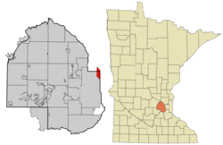
St. Anthony, also called Saint Anthony Village, is a friendly city in the state of Minnesota, USA. It's special because it's located in two different counties: Hennepin and Ramsey. In 2020, about 9,257 people lived here. The city is managed by a group of five leaders: a mayor and four council members. These leaders work for four-year terms to help the city run smoothly.
Contents
Discovering St. Anthony's Past
The story of St. Anthony began in 1838. A store owner named Franklin Steele claimed land east of St. Anthony Falls. He started developing this land in 1848. Soon, it became a busy place for mills and trade, much like the nearby town of Minneapolis. In 1858, the area was officially named the Township of St. Anthony.
In 1872, Minneapolis took over most of St. Anthony. However, about 1,000 acres of farmland north of the city kept the name St. Anthony. This area remained unincorporated for many years. Then, in 1945, the people living there voted to become a village. Even though the state questioned this because it was mostly farmland, the Minnesota Supreme Court said yes. As more suburbs grew, St. Anthony changed from a rural area to a busy inner suburb.
St. Anthony was once home to Apache Plaza, which opened in 1961. This was the tenth indoor shopping mall in the United States! The very first indoor mall, Southdale, was only 15 miles away. It opened a few years earlier in 1956. St. Anthony also had Minnesota's first strip mall, the St. Anthony Shopping Center, built in the 1950s.
The St. Anthony Village High School Huskies have a proud sports history. They won their first state baseball championship in 2006 and again in 2008. The school has also won five state championships in Knowledge Bowl and one Minnesota Science Bowl competition.
Where is St. Anthony Located?
St. Anthony is about 4 miles northeast of downtown Minneapolis. The city covers a total area of 2.37 square miles. Most of this area, about 2.25 square miles, is land. The rest, 0.12 square miles, is water.
One of the most important streets in St. Anthony is Silver Lake Road. It's named after Silver Lake, which is in the northwest part of the city. This road runs all the way from the north to the south of St. Anthony. County Highway 88 is another main road. Interstate 35W also passes near the southern part of the city.
Who Lives in St. Anthony?
| Historical population | |||
|---|---|---|---|
| Census | Pop. | %± | |
| 1850 | 656 | — | |
| 1860 | 265 | −59.6% | |
| 1870 | 236 | −10.9% | |
| 1880 | 485 | 105.5% | |
| 1890 | 92 | −81.0% | |
| 1900 | 93 | 1.1% | |
| 1910 | 100 | 7.5% | |
| 1920 | 134 | 34.0% | |
| 1930 | 455 | 239.6% | |
| 1940 | 607 | 33.4% | |
| 1950 | 1,406 | 131.6% | |
| 1960 | 5,084 | 261.6% | |
| 1970 | 9,239 | 81.7% | |
| 1980 | 7,981 | −13.6% | |
| 1990 | 7,727 | −3.2% | |
| 2000 | 8,012 | 3.7% | |
| 2010 | 8,226 | 2.7% | |
| 2020 | 9,257 | 12.5% | |
| 2022 (est.) | 10,124 | 23.1% | |
| U.S. Decennial Census 2020 Census |
|||
St. Anthony's Population in 2010
In 2010, there were 8,226 people living in St. Anthony. These people lived in 3,848 households, and 2,054 of these were families. The city had about 3,656 people per square mile.
Most of the people in St. Anthony were White (85.1%). Other groups included African American (5.0%), Asian (5.9%), and Native American (0.6%). About 2.9% of the population was Hispanic or Latino.
About 21.5% of households had children under 18. Many households (42.5%) were married couples. The average household had 2.11 people, and the average family had 2.83 people. The average age in the city was 43.1 years old. About 17.5% of residents were under 18, and 21.4% were 65 or older.
Learning in St. Anthony
St. Anthony is part of the St. Anthony-New Brighton School District, known as ISD 282.
- Wilshire Park Elementary School is for younger students.
- St. Anthony Middle School serves students in grades 6-8.
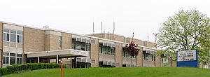
- St. Anthony Village High School is for grades 9-12.
- St. Charles Borromeo also offers private education for students from kindergarten to 8th grade.
Fun and Recreation
St. Anthony has many city parks for everyone to enjoy.
- Central Park is the biggest and most well-known. It's located in the middle of the city, near the high school and community center. Some of the high school's sports teams play their games here.
- Other smaller parks include Emerald Park, Silver Point Park, and Trillium Park.
- The city also has a golf course. It is managed by the Minneapolis Parks and Recreation Board.
- Silverwood Park is a county park. It is maintained by the Three Rivers Park District. Silverwood Park is located on Silver Lake, which is mostly within St. Anthony's borders.
St. Anthony's Sister City
St. Anthony Village has one special "sister city" far away. This partnership is set up by Sister Cities International.
- The sister city is Salo, Finland.
To celebrate this friendship, St. Anthony dedicated Salo Park on June 8, 2006. This park is part of the Silver Lake Village development in St. Anthony.
See also
 In Spanish: St. Anthony (Minnesota) para niños


