St. Augustine Beach, Florida facts for kids
Quick facts for kids
St. Augustine Beach, Florida
|
|
|---|---|
| City of St. Augustine Beach | |
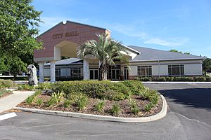
St. Augustine Beach City Hall
|
|
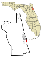
Location in St. Johns County and the state of Florida
|
|
| Country | |
| State | |
| County | St. Johns |
| Incorporated | 1959 |
| Government | |
| • Type | Commission–Manager |
| Area | |
| • Total | 2.17 sq mi (5.61 km2) |
| • Land | 2.12 sq mi (5.50 km2) |
| • Water | 0.04 sq mi (0.11 km2) |
| Elevation | 7 ft (2 m) |
| Population
(2020)
|
|
| • Total | 6,803 |
| • Density | 3,202.92/sq mi (1,236.59/km2) |
| Time zone | UTC-5 (Eastern (EST)) |
| • Summer (DST) | UTC-4 (EDT) |
| ZIP code |
32080
|
| Area code(s) | 904, 324 |
| FIPS code | 12-62525 |
| GNIS feature ID | 0308102 |
| Website | http://www.staugbch.com |
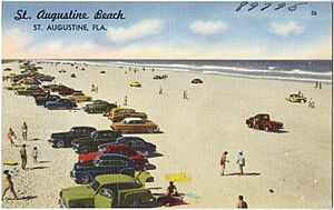
St. Augustine Beach is a city located in St. Johns County, Florida, in the United States. It's a popular place with a beautiful beach. In 2020, about 6,803 people lived there. This was more than the 6,176 people who lived there in 2010. St. Augustine Beach is also part of the larger Jacksonville area.
Contents
Exploring St. Augustine Beach
Where is St. Augustine Beach?
St. Augustine Beach is found at these coordinates: 29°50′37″N 81°16′20″W / 29.84361°N 81.27222°W.
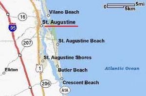
The city covers an area of about 1.9 square miles (5.0 square kilometers). All of this area is land. The city is bordered by the Atlantic Ocean to the east. To the west, it's bordered by Florida State Road A1A. Pope Road is its northern border, and the Sandpiper Village neighborhood is to the south.
How Many People Live Here?
The number of people living in St. Augustine Beach has grown over the years:
| Historical population | |||
|---|---|---|---|
| Census | Pop. | %± | |
| 1960 | 396 | — | |
| 1970 | 632 | 59.6% | |
| 1980 | 1,289 | 104.0% | |
| 1990 | 3,657 | 183.7% | |
| 2000 | 4,683 | 28.1% | |
| 2010 | 6,176 | 31.9% | |
| 2020 | 6,803 | 10.2% | |
| U.S. Decennial Census | |||
Population Details (2010 and 2020)
The United States Census Bureau collects information about people living in cities. Here's a quick look at the different groups of people in St. Augustine Beach:
| Race | Pop 2010 | Pop 2020 | % 2010 | % 2020 |
|---|---|---|---|---|
| White (NH) | 5,734 | 6,028 | 92.84% | 88.61% |
| Black or African American (NH) | 43 | 33 | 0.70% | 0.49% |
| Native American or Alaska Native (NH) | 15 | 6 | 0.24% | 0.09% |
| Asian (NH) | 72 | 78 | 1.17% | 1.15% |
| Pacific Islander or Native Hawaiian (NH) | 2 | 4 | 0.03% | 0.06% |
| Some other race (NH) | 7 | 47 | 0.11% | 0.69% |
| Two or more races/Multiracial (NH) | 71 | 233 | 1.15% | 3.42% |
| Hispanic or Latino (any race) | 232 | 374 | 3.76% | 5.50% |
| Total | 6,176 | 6,803 |
In 2020, there were 6,803 people living in the city. These people lived in 2,851 households. About 1,762 of these households were families.
In 2010, there were 6,176 people. They lived in 5,494 households, and 2,546 of these were families.
Getting Around St. Augustine Beach
Main Roads
There are a few main roads that help people travel in and out of St. Augustine Beach:
 State Road A1A runs north and south along the coast.
 County Road A1A also runs north and south.
 State Road 312 runs east and west.
Bus Services
The Sunshine Bus Company provides bus service in the area. Even though it's based in St. Augustine Beach, its buses also go to nearby St. Augustine, including its historic areas. You can also take a bus to shopping centers. Some buses even go to Hastings and Jacksonville. In Jacksonville, you can connect to the JTA for more bus routes.
Learning and Libraries
The schools in St. Augustine Beach are part of the St. Johns County School District.
Elementary Schools
Most students go to R. B. Hunt Elementary School. A smaller part of the city is served by W. D. Hartley Elementary School.
Middle Schools
For middle school, most students attend Sebastian Middle School. A small number of students go to Gamble Rogers Middle School.
High Schools
Most high school students attend St. Augustine High School. A smaller section of the city is zoned for Pedro Menendez High School.
Libraries
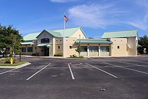
The St. Johns County Public Library system has a branch called the Anastasia Island Beach Branch. It's a great place to find books and learn new things.
See also
 In Spanish: St. Augustine Beach para niños


