St. Charles, Kentucky facts for kids
Quick facts for kids
St. Charles, Kentucky
|
|
|---|---|

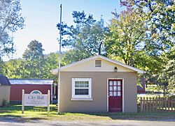
City Hall
|
|

Location of St. Charles in Hopkins County, Kentucky.
|
|
| Country | United States |
| State | Kentucky |
| County | Hopkins |
| Area | |
| • Total | 1.00 sq mi (2.59 km2) |
| • Land | 0.99 sq mi (2.57 km2) |
| • Water | 0.01 sq mi (0.02 km2) |
| Elevation | 440 ft (134 m) |
| Population
(2020)
|
|
| • Total | 273 |
| • Density | 274.92/sq mi (106.15/km2) |
| Time zone | UTC-6 (Central (CST)) |
| • Summer (DST) | UTC-5 (CDT) |
| ZIP code |
42453
|
| Area code(s) | 270 and 364 |
| FIPS code | 21-67710 |
| GNIS feature ID | 0502599 |
St. Charles is a small city located in Hopkins County, Kentucky, in the United States. It's known as a "home rule-class city," which means it has its own local government to make decisions for its community. In 2020, about 273 people lived there.
Contents
A Look Back: History of St. Charles
St. Charles started as a coal mining town in 1872. A company called the Saint Bernard Mining Company bought the land from J.I.D. Woodruff to set up their mining operations.
In 1873, a post office was opened in the area. It was first named "Woodruff" after the person who owned the land. However, when the city officially became a town in 1874, its name was changed to "St. Charles." The exact reason for this name change is not known today.
Where is St. Charles? Geography
St. Charles is located in the southern part of Hopkins County. You can find it at these coordinates: 37 degrees 11 minutes 3 seconds North, and 87 degrees 33 minutes 19 seconds West.
A main road, U.S. Route 62, runs through the southern part of the city. If you travel east on this road, you'll reach Nortonville in about 6 miles. If you go west, you'll get to Dawson Springs in about 8 miles.
The United States Census Bureau says that St. Charles covers a total area of about 2.6 square kilometers (or 1.0 square mile). A very small part of this area, about 0.02 square kilometers (or 0.01 square miles), is water.
Who Lives in St. Charles? Demographics
| Historical population | |||
|---|---|---|---|
| Census | Pop. | %± | |
| 1880 | 356 | — | |
| 1890 | 449 | 26.1% | |
| 1900 | 753 | 67.7% | |
| 1910 | 660 | −12.4% | |
| 1920 | 604 | −8.5% | |
| 1930 | 634 | 5.0% | |
| 1940 | 536 | −15.5% | |
| 1950 | 534 | −0.4% | |
| 1960 | 421 | −21.2% | |
| 1970 | 373 | −11.4% | |
| 1980 | 405 | 8.6% | |
| 1990 | 316 | −22.0% | |
| 2000 | 309 | −2.2% | |
| 2010 | 277 | −10.4% | |
| 2020 | 273 | −1.4% | |
| U.S. Decennial Census | |||
The population of St. Charles has changed over many years. In 1880, there were 356 people, and the population grew to its highest in 1900 with 753 residents. Since then, the number of people living in St. Charles has slowly decreased. In 2020, the population was 273.
According to the census from 2000, there were 309 people living in the city. Most of the people living in St. Charles were White. A small number of people were Pacific Islander or from two or more racial backgrounds.
There were 120 households in the city. Many of these households (about 59%) were married couples living together. About 37.5% of households had children under 18 living with them. Some households (about 21.7%) were made up of just one person.
The people in St. Charles were of various ages. About 25.9% of the population was under 18 years old. About 32.7% were between 25 and 44 years old. And about 12.9% were 65 years old or older. The average age of people in the city was 36 years.
In 2000, the average yearly income for a household in St. Charles was about $20,469. For families, the average income was around $20,000. About 29.2% of the people in St. Charles lived below the poverty line, which means they had lower incomes. This included about 40.6% of children under 18.
See also
 In Spanish: St. Charles (Kentucky) para niños

