
Dawson Springs, Kentucky facts for kids
Quick facts for kids
Dawson Springs, Kentucky
|
|
|---|---|

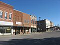
Railroad Avenue downtown (2014)
|
|

Location within Hopkins County and Kentucky
|
|
| Country | United States |
| State | Kentucky |
| Counties | Caldwell, Hopkins |
| Area | |
| • Total | 3.93 sq mi (10.17 km2) |
| • Land | 3.84 sq mi (9.94 km2) |
| • Water | 0.09 sq mi (0.23 km2) |
| Elevation | 420 ft (130 m) |
| Population
(2020)
|
|
| • Total | 2,452 |
| • Estimate
(2022)
|
2,420 |
| • Density | 638.87/sq mi (246.70/km2) |
| Time zone | UTC-6 (CST) |
| • Summer (DST) | UTC-5 (CDT) |
| ZIP code |
42408
|
| Area code | 270 & 364 |
| FIPS code | 21-20224 |
| GNIS ID | 490696 |
Dawson Springs is a small city located in Hopkins and Caldwell counties in the state of Kentucky, United States. It's known as a "home rule-class city," which means it has the power to govern itself on local matters. In 2020, about 2,452 people lived there.
Contents
Discovering Dawson Springs' Past
Dawson Springs has a really interesting history! It was first known as Tradewater Bend. In 1832, two brothers named Menser officially made it a city, calling it Dawson City.
A Popular Spa Town Era
From the late 1800s to the 1930s, Dawson Springs was famous as a spa and resort town. People believed the local spring waters had healing powers. Visitors, especially from big cities like Chicago and Louisville, came to relax and get better. Many large hotels and boarding houses were built to welcome them.
Tourism was at its peak in 1901 when over 50,000 visitors came to this small town. Even the Pittsburgh Pirates, a famous baseball team, used to hold their spring training here in the 1910s! However, as cars became more common, people started driving to other vacation spots further south. This led to the end of the town's spa era.
Changes and Challenges
In 1922, the Outwood Veterans Hospital was built in Dawson Springs. The town's economy also got stronger when coal mining began at the Dawson Daylight Mine. Later, in the mid-1900s, the town added light manufacturing jobs. But in the 1990s, many of these factory jobs moved to other countries, which was a tough time for the town.
Today, Dawson Springs is still a popular place for tourists. This is thanks to the Pennyrile Forest State Resort Park. This park was created in the 1930s when a local river was dammed, forming a beautiful lake. The town is also known as Kentucky's first "Trail Town" because of its great hiking and horse riding trails.
The 2021 Tornado Event
On the evening of December 10, 2021, a very strong EF4 tornado hit Dawson Springs. A large part of the city was damaged. Sadly, 19 people lost their lives during this powerful storm. The community has been working hard to rebuild since then.
Exploring Dawson Springs' Location
Dawson Springs is located in the southwestern part of Hopkins County. Its southern and western edge is formed by the Tradewater River. This river also marks the border between Hopkins and Caldwell counties. A small part of Dawson Springs actually stretches across the river into Caldwell County.
Roads and Travel
U.S. Route 62 goes right through the middle of the city. You can take it east to Nortonville (about 14 miles away) or west to Princeton (about 12 miles away). Interstate 69 also runs near the northern edge of Dawson Springs, making it easy to get to from other places.
Climate in Dawson Springs
The weather in Dawson Springs usually has hot and humid summers. Winters are generally mild to cool. This type of weather is called a humid subtropical climate.
People of Dawson Springs
| Historical population | |||
|---|---|---|---|
| Census | Pop. | %± | |
| 1890 | 525 | — | |
| 1900 | 935 | 78.1% | |
| 1910 | 1,350 | 44.4% | |
| 1920 | 1,762 | 30.5% | |
| 1930 | 2,311 | 31.2% | |
| 1940 | 2,560 | 10.8% | |
| 1950 | 2,374 | −7.3% | |
| 1960 | 3,002 | 26.5% | |
| 1970 | 3,009 | 0.2% | |
| 1980 | 3,275 | 8.8% | |
| 1990 | 3,129 | −4.5% | |
| 2000 | 2,980 | −4.8% | |
| 2010 | 2,764 | −7.2% | |
| 2020 | 2,452 | −11.3% | |
| 2022 (est.) | 2,420 | −12.4% | |
| U.S. Decennial Census | |||
In 2000, there were about 2,980 people living in Dawson Springs. About 23% of the population was under 18 years old. The median age was 40 years. Most people living in the city were White (97.72%).
Education in Dawson Springs
Dawson Springs has its own lending library. It's a part of the Hopkins County-Madisonville Public Library system. The town also has its own school district for students from kindergarten all the way through 12th grade. This school district is actually the main employer in the town!
Famous People from Dawson Springs
Some notable people have come from Dawson Springs:
- Steve Beshear – He was the 61st Governor of Kentucky.
- Scott Jennings – A well-known political strategist.
- Mila Mason – A talented country music artist.
- Dottie Rambo – A famous gospel music artist.
Images for kids
-
Railroad Avenue downtown (2014)
See also
 In Spanish: Dawson Springs (Kentucky) para niños
