St. Gabriel, Louisiana facts for kids
Quick facts for kids
St. Gabriel, Louisiana
|
|
|---|---|
| City of St. Gabriel | |

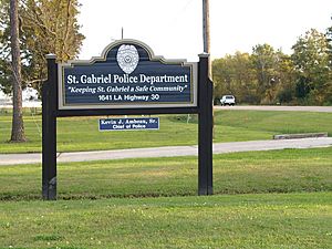
St. Gabriel Police Department
|
|

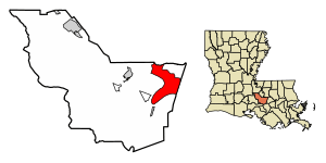
Location of St. Gabriel in Iberville Parish, Louisiana.
|
|

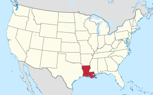
Location of Louisiana in the United States
|
|
| Country | United States |
| State | Louisiana |
| Parish | Iberville |
| Incorporated | 1994 (town) |
| City Designation | 2001 |
| Area | |
| • Total | 29.88 sq mi (77.39 km2) |
| • Land | 29.66 sq mi (76.81 km2) |
| • Water | 0.22 sq mi (0.58 km2) |
| Elevation | 23 ft (7 m) |
| Population
(2020)
|
|
| • Total | 6,433 |
| • Density | 216.91/sq mi (83.75/km2) |
| Time zone | UTC-6 (CST) |
| • Summer (DST) | UTC-5 (CDT) |
| ZIP Codes |
70721, 70776, 70780
|
| Area code(s) | 225 |
| FIPS code | 22-67250 |
| Website | http://www.cityofstgabriel.us |
St. Gabriel is a city in Iberville Parish, Louisiana, United States. It's part of the Baton Rouge area. In 2020, about 6,433 people lived there.
St. Gabriel became a town in 1994 and a city in 2001. It is located on the east side of the Mississippi River. This is about 12 miles south of Baton Rouge. Bayou Manchac forms a natural border for the city. The area used to be mostly farms. Now, it is known for the petrochemical industry, which makes products from oil and gas.
Contents
History of St. Gabriel
This part of Louisiana is called Acadiana. It was settled by the Acadians. They came here after being forced out of Nova Scotia in the mid-1700s.
Founding the Parish
In 1769, Governor Luis de Unzaga of New Orleans allowed a new church parish to be created. This parish was for the Acadians. It was located near the Mississippi River, between Baton Rouge and the town of Gonzales.
Between 1771 and 1773, Governor Unzaga gave the land and permission to build the church. The church was built between 1774 and 1776.
St. Gabriel Catholic Church
St. Gabriel Catholic Church is one of Louisiana's oldest churches. People believe the parish started in 1769. In 2008, during Hurricane Gustav, the church's steeple was damaged.
Geography of St. Gabriel
St. Gabriel covers about 29.0 square miles (75.0 km2). Most of this area is land. Only a small part is water. The city is on the east bank of the Mississippi River. It is located between Ascension Parish and East Baton Rouge Parish.
St. Gabriel is about 12 miles (19 km) east of Baton Rouge. It is also about 70 miles (110 km) from New Orleans. The communities of Carville and part of Sunshine are inside the city limits.
Population and People
St. Gabriel has seen its population change over the years.
| Historical population | |||
|---|---|---|---|
| Census | Pop. | %± | |
| 2000 | 5,514 | — | |
| 2010 | 6,677 | 21.1% | |
| 2020 | 6,433 | −3.7% | |
| U.S. Decennial Census | |||
Racial and Ethnic Makeup
The city's population includes people from many backgrounds. In 2020, the population was 6,433.
| Race / Ethnicity (NH = Non-Hispanic) | Pop 2000 | Pop 2010 | Pop 2020 | % 2000 | % 2010 | % 2020 |
|---|---|---|---|---|---|---|
| White alone (NH) | 1,457 | 2,209 | 2,464 | 26.42% | 33.08% | 38.30% |
| Black or African American alone (NH) | 3,956 | 4,219 | 3,095 | 71.74% | 63.19% | 48.11% |
| Native American or Alaska Native alone (NH) | 3 | 7 | 3 | 0.05% | 0.10% | 0.05% |
| Asian alone (NH) | 18 | 20 | 62 | 0.33% | 0.30% | 0.96% |
| Pacific Islander alone (NH) | 1 | 0 | 1 | 0.02% | 0.00% | 0.02% |
| Other race alone (NH) | 2 | 3 | 28 | 0.04% | 0.04% | 0.44% |
| Mixed race or Multiracial (NH) | 15 | 53 | 114 | 0.27% | 0.79% | 1.77% |
| Hispanic or Latino (any race) | 62 | 166 | 666 | 1.12% | 2.49% | 10.35% |
| Total | 5,514 | 6,677 | 6,433 | 100.00% | 100.00% | 100.00% |
In 2020, the population was made up of different groups. About 48.1% were non-Hispanic Black people. About 38.3% were non-Hispanic white people. Other groups included Asian, Native American, and multiracial people. About 10.4% of the population was Hispanic or Latino.
The number of Black residents decreased in 2020. This was because the Louisiana Correctional Institute for Women closed. It had been damaged by flooding in 2016.
Households and Income
In 2000, there were 898 households in St. Gabriel. About 35.6% of these homes had children under 18. The average household size was 2.79 people.
By 2019, there were 1,635 households. The average number of people per household was 2.53. The median age in St. Gabriel was 37.7 years old. Most of the population (88.2%) was 18 or older.
The median household income in 2019 was $48,259. This was higher than in 2000. The income per person was $17,153. About 20.0% of the people lived at or below the poverty line.
Education in St. Gabriel
St. Gabriel has schools and a library for its residents.
Local Schools
The Iberville Parish School Board runs East Iberville School. This school teaches students from kindergarten through 12th grade. For a long time, it was the only school in the city.
The Mathematics, Science, and Arts Academy - East opened in St. Gabriel in 2008. Some families also choose to send their children to private schools. These schools are in the Greater Baton Rouge area or near Gonzales, Louisiana.
In 2013, some city officials wanted St. Gabriel to have its own school district. They felt that the schools in their area were not getting enough attention.
Public Library
The Iberville Parish Library has a branch in St. Gabriel. It is called the East Iberville Branch Library.
Notable People from St. Gabriel
Several famous people have connections to what is now St. Gabriel:
- James Carville – a well-known political consultant.
- James Gallier – a famous architect.
Images for kids
See also
 In Spanish: St. Gabriel (Luisiana) para niños
 | James B. Knighten |
 | Azellia White |
 | Willa Brown |


