
St. Peterzell facts for kids
Quick facts for kids
St. Peterzell
|
||
|---|---|---|
 |
||
|
||

St. Peterzell
Location in Switzerland

St. Peterzell
Location in Canton of St. Gallen
|
||
| Country | Switzerland | |
| Canton | St. Gallen | |
| District | Toggenburg | |
| Area | ||
| • Total | 9.38 km2 (3.62 sq mi) | |
| Elevation | 710 m (2,330 ft) | |
| Population | ||
| • Total | 1,203 | |
| • Density | 128.25/km2 (332.17/sq mi) | |
| Postal code |
9127
|
|
| Surrounded by | Degersheim, Hemberg, Mogelsberg, Schönengrund (AR), Schwellbrunn (AR) | |

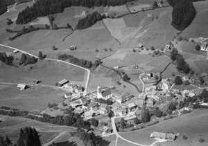
St. Peterzell was once a small town, also called a municipality, in Switzerland. It was located in the eastern part of the country. This area is known as the canton of St. Gallen.
St. Peterzell was an independent municipality for many years. But on January 1, 2009, things changed. It joined with two other nearby towns. These towns were Brunnadern and Mogelsberg. Together, they formed a new, larger municipality. This new municipality is called Neckertal.
Where is St. Peterzell?
St. Peterzell is in the Toggenburg region. This region is a "Wahlkreis," which means an election district. It is part of the canton of St. Gallen.
Location Details
The town is located at about 47 degrees North and 9 degrees East. This helps people find it on a map. St. Peterzell sits at an elevation of 710 meters. That's about 2,329 feet above sea level.
People and Size
In January 2004, about 1,203 people lived in St. Peterzell. The town covered an area of 9.38 square kilometers. That's about 3.62 square miles.
Joining Other Towns
St. Peterzell is no longer a separate town. It became part of Neckertal in 2009. This merger helped the towns work together. They could share resources and services better.
See also
 In Spanish: Sankt Peterzell para niños
