Staple Hill (Somerset) facts for kids
Quick facts for kids Staple Hill |
|
|---|---|

Staple Hill Plantations
|
|
| Highest point | |
| Elevation | 315 m (1,033 ft) |
| Prominence | 212 m (696 ft) |
| Parent peak | Dunkery Beacon |
| Listing | Marilyn, Hardy |
| Geography | |
| Location | Blackdown Hills, England |
| OS grid | ST240166 |
| Topo map | OS Landranger 193 |
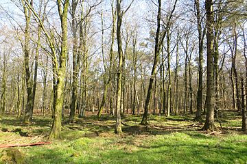
Staple Hill is a fantastic natural spot located in the English county of Somerset. It stands proudly as the highest point within the lovely Blackdown Hills. This makes it a special place for exploring nature and enjoying great views.
Contents
Discovering Staple Hill's Charm
Staple Hill is more than just a high point; it's a place with unique features that make it interesting for hikers and nature lovers. It's known for its beautiful surroundings and the trails that wind through its woodlands.
Where is Staple Hill Located?
Staple Hill is found in the southwest of England, specifically in the county of Somerset. It is part of the Blackdown Hills, which is an area of outstanding natural beauty. These hills stretch across parts of Somerset and Devon, offering rolling landscapes and peaceful forests.
What Makes Staple Hill Special?
Staple Hill is recognized as both a Marilyn and a Hardy. These are special categories for hills in the United Kingdom.
- A Marilyn is a hill that is at least 150 meters (about 492 feet) higher than the land around it. This means Staple Hill stands out from its surroundings.
- A Hardy is a hill that is at least 200 meters (about 656 feet) high and has a drop of at least 30 meters (about 98 feet) on all sides. These classifications show that Staple Hill is a significant and noticeable peak.
Exploring the Area: Walks and Trails
Staple Hill is a great place for outdoor adventures, especially walking. It's part of the Forestry Commission woodlands, which means there are well-maintained paths for everyone to enjoy.
The Staple Fitzpaine Herepath
One of the exciting trails connected to Staple Hill is the Staple Fitzpaine Herepath. This path is a popular route for walking, cycling, and horse riding through the beautiful forest. It allows visitors to explore the wider woodland area around the hill.
Accessible Loop Walk
For those looking for a shorter, easier walk, there's a special loop walk at Staple Hill.
- This walk starts from a car parking area.
- It is about 800 meters (half a mile) long.
- The paths were improved in 2009 to be suitable for people with disabilities, making it accessible for many visitors.
- Along the loop, you can find a couple of viewpoints that offer lovely sights of the surrounding countryside.
 | May Edward Chinn |
 | Rebecca Cole |
 | Alexa Canady |
 | Dorothy Lavinia Brown |

