Stark, Kansas facts for kids
Quick facts for kids
Stark, Kansas
|
|
|---|---|

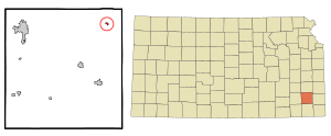
Location within Neosho County and Kansas
|
|

|
|
| Country | United States |
| State | Kansas |
| County | Neosho |
| Founded | 1888 |
| Platted | 1888 |
| Incorporated | 1910 |
| Named for | Stark County, Illinois |
| Area | |
| • Total | 0.16 sq mi (0.43 km2) |
| • Land | 0.16 sq mi (0.43 km2) |
| • Water | 0.00 sq mi (0.00 km2) |
| Elevation | 1,063 ft (324 m) |
| Population
(2020)
|
|
| • Total | 69 |
| • Density | 431/sq mi (160.5/km2) |
| Time zone | UTC-6 (CST) |
| • Summer (DST) | UTC-5 (CDT) |
| ZIP code |
66775
|
| Area code | 620 |
| FIPS code | 20-68025 |
| GNIS ID | 2395957 |
Stark is a small city located in Neosho County, Kansas, in the United States. In 2020, the city had a population of 69 people. It's a quiet place with a rich history.
Contents
A Look Back: Stark's History
The first post office in Stark opened its doors in January 1886. This was an important step for the community.
Stark was officially planned and mapped out in 1888. This process is called "platting." The city was named after Stark County, Illinois. A railroad, the Kansas City Pacific Railroad, built tracks right through Stark. They even had special buildings called depots for passengers and freight. This rail line later became part of the Missouri-Kansas-Texas Railroad. Today, it is still used by the Union Pacific Railroad.
Where is Stark? Geography Facts
The United States Census Bureau reports that Stark covers a total area of about 0.17 square miles (0.43 square kilometers). All of this area is land.
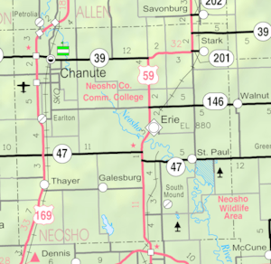
Stark is located to the east of U.S. Route 59. You can find it along K-201, which is a state highway.
Who Lives in Stark? Population Details
| Historical population | |||
|---|---|---|---|
| Census | Pop. | %± | |
| 1910 | 191 | — | |
| 1920 | 189 | −1.0% | |
| 1930 | 197 | 4.2% | |
| 1940 | 160 | −18.8% | |
| 1950 | 157 | −1.9% | |
| 1960 | 96 | −38.9% | |
| 1970 | 124 | 29.2% | |
| 1980 | 143 | 15.3% | |
| 1990 | 79 | −44.8% | |
| 2000 | 106 | 34.2% | |
| 2010 | 72 | −32.1% | |
| 2020 | 69 | −4.2% | |
| U.S. Decennial Census | |||
Stark's Population in 2010
In 2010, the city of Stark had 72 residents. These people lived in 39 different households. Out of these, 25 were families.
The population density was about 423.5 people per square mile. There were 48 housing units in total. All of the people living in Stark were identified as White.
About 10.3% of the households had children under 18 years old. Nearly half (48.7%) were married couples living together. Some households (7.7%) had a female head without a husband. Another 7.7% had a male head without a wife. About 35.9% of households were not families.
Almost one-third (30.8%) of all households had only one person living there. About 7.7% of these single-person households were people aged 65 or older. The average household had 1.85 people. The average family had 2.20 people.
The average age of people in Stark was 54.3 years. About 8.3% of residents were under 18. Another 8.5% were between 18 and 24. A quarter (25%) were between 25 and 44. About 31.9% were between 45 and 64. Lastly, 26.4% were 65 years old or older. The city had slightly more males (54.2%) than females (45.8%).
See also
 In Spanish: Stark (Kansas) para niños
 | Victor J. Glover |
 | Yvonne Cagle |
 | Jeanette Epps |
 | Bernard A. Harris Jr. |

