Steavenson River facts for kids
Quick facts for kids Steavenson |
|
|---|---|

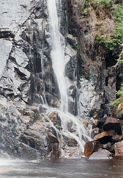
One of the five drops of the Steavenson Falls situated on the Steavenson River.
|
|
| Native name | Nur-ro-nur-ro |
| Other name(s) | Steavensons, Stevenson |
| Country | Australia |
| State | Victoria |
| Region | South Eastern Highlands bioregion (IBRA), Northern Country/North Central |
| Local government area | Murrindindi |
| Towns | Marysville, Buxton |
| Physical characteristics | |
| Main source | Yarra Ranges, Great Dividing Range below Mount Edgar 813 m (2,667 ft) 37°32′40″S 145°47′10″E / 37.54444°S 145.78611°E |
| River mouth | confluence with the Acheron River near Buxton 264 m (866 ft) 37°24′58″S 145°41′55″E / 37.41611°S 145.69861°E |
| Length | 20 km (12 mi) |
| Basin features | |
| River system | Goulburn Broken catchment, Murray-Darling basin |
| Tributaries |
|
| National park | Yarra Ranges National Park |
The Steavenson River is a smaller river in Victoria, Australia. It flows all year round and is part of the larger Goulburn Broken river system. This system then joins the huge Murray-Darling basin.
The river starts high up in the Yarra Ranges, near Mount Edgar. It flows down to join the Acheron River close to the town of Buxton. Sometimes, people mistakenly call it the Steavensons River.
Contents
Where Does the Steavenson River Flow?
The Steavenson River begins in the Yarra Ranges National Park. This park is part of Australia's long Great Dividing Range. The river starts below Mount Edgar and flows mostly north-west.
As it moves, the river passes through wild national park areas. It is joined by three smaller streams, including the Taggerty River. Finally, it meets the Acheron River near the town of Buxton.
The river drops about 549 meters (1,801 feet) from its start to where it ends. Its total length is about 20 kilometers (12 miles).
River Crossings and Other Branches
The Maroondah Highway crosses over the Steavenson River just south of Buxton.
There's also a part of the river called the Little Steavenson River. This smaller branch splits off from the main river. It also flows into the Acheron River near Buxton.
Steavenson Falls: A Beautiful Waterfall
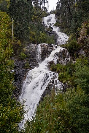
One of the most famous spots on the river is Steavenson Falls. This amazing waterfall is 122 meters (400 feet) tall. It's known as a horsetail waterfall because of how the water spreads out as it falls.
The falls drop in five different sections. The very last drop is more than 21 meters (69 feet) straight down. You can find Steavenson Falls about 3.4 kilometers (2.1 miles) east of Marysville.
Impact of Bushfires
In 2009, a big event called the Black Saturday bushfires happened. These fires caused a lot of damage to the area around the river on February 7, 2009. Much of the land that collects water for the river was affected. Many buildings were destroyed, and the forest was badly damaged.
What Does the Name Steavenson Mean?
In an Aboriginal language of Australia, the river is thought to be called Nur-ro-nur-ro. However, we don't know what this name means.
Some people believe that the lower part of the Steavenson River might have first been called the Taggerty River. This was before the name Steavenson was officially given to it. This part of the river runs from where the Taggerty River joins it, near a place called Vic Oak, all the way to where it meets the Acheron River near Buxton.
 | William Lucy |
 | Charles Hayes |
 | Cleveland Robinson |


