Stewart, Minnesota facts for kids
Quick facts for kids
Stewart, Minnesota
|
|
|---|---|

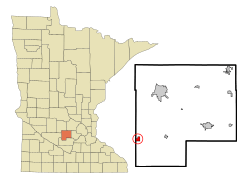
Location in McLeod County and the state of Minnesota
|
|
| Country | United States |
| State | Minnesota |
| County | McLeod |
| Area | |
| • Total | 0.81 sq mi (2.10 km2) |
| • Land | 0.81 sq mi (2.09 km2) |
| • Water | 0.00 sq mi (0.01 km2) |
| Elevation | 1,066 ft (325 m) |
| Population
(2020)
|
|
| • Total | 489 |
| • Density | 604.45/sq mi (233.46/km2) |
| Time zone | UTC-6 (Central (CST)) |
| • Summer (DST) | UTC-5 (CDT) |
| ZIP code |
55385
|
| Area code(s) | 320 |
| FIPS code | 27-62788 |
| GNIS feature ID | 2395966 |
Stewart is a small city in McLeod County, Minnesota, in the United States. It's a quiet place with a population of 489 people, according to the 2020 census. This number was a little lower than in 2010, when 571 people lived there.
Stewart's Story
Stewart was officially planned out in 1888 by a person named Dr. D. A. Stewart. The city was named after him! Later that same year, Stewart became an "incorporated" city. This means it got its own local government and could make its own rules.
Where is Stewart?
Stewart is located in the southwestern part of McLeod County. On its western side, it touches Renville County. A main road, U.S. Route 212, goes through the southern part of the city. If you drive east on this road for about 17 miles, you'll reach Glencoe, which is the main city of McLeod County. If you go west for about 11 miles, you'll get to Hector.
The city covers a total area of about 0.81 square miles (2.10 square kilometers). Most of this area is land, with only a very small part (about 0.003 square miles) being water. A tiny piece of Round Grove Lake is actually inside the city limits, right in the southwest corner.
Stewart is quite flat because it sits on the eastern edge of a large flat area called the Great Plains.
People of Stewart
Stewart has seen its population change over the years. Here's a quick look at how many people have lived there:
| Historical population | |||
|---|---|---|---|
| Census | Pop. | %± | |
| 1880 | 80 | — | |
| 1890 | 166 | 107.5% | |
| 1900 | 407 | 145.2% | |
| 1910 | 412 | 1.2% | |
| 1920 | 540 | 31.1% | |
| 1930 | 541 | 0.2% | |
| 1940 | 636 | 17.6% | |
| 1950 | 695 | 9.3% | |
| 1960 | 676 | −2.7% | |
| 1970 | 666 | −1.5% | |
| 1980 | 616 | −7.5% | |
| 1990 | 566 | −8.1% | |
| 2000 | 564 | −0.4% | |
| 2010 | 571 | 1.2% | |
| 2020 | 489 | −14.4% | |
| U.S. Decennial Census | |||
Stewart's Population in 2010
In 2010, there were 571 people living in Stewart. These people made up 235 households, and 152 of those were families. The city had about 705 people per square mile.
Most of the people in Stewart (97.4%) were White. A small number were Asian (0.2%), from other races (1.8%), or from two or more races (0.7%). About 4.2% of the population identified as Hispanic or Latino.
About 31% of the households had children under 18 living with them. Many households (46.8%) were married couples. Some households were led by a single parent, either a mom (9.4%) or a dad (8.5%). About 29% of all households were people living alone.
The average age in Stewart in 2010 was about 39 years old. About 24% of the residents were under 18. About 11.4% were 65 years or older. The population was almost evenly split between males (50.8%) and females (49.2%).
See also
 In Spanish: Stewart (Minnesota) para niños

