
McLeod County, Minnesota facts for kids
Quick facts for kids
McLeod County
|
|
|---|---|

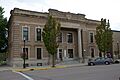
McLeod County Courthouse
|
|

Location within the U.S. state of Minnesota
|
|
 Minnesota's location within the U.S. |
|
| Country | |
| State | |
| Founded | March 1, 1856 |
| Named for | Martin McLeod |
| Seat | Glencoe |
| Largest city | Hutchinson |
| Area | |
| • Total | 506 sq mi (1,310 km2) |
| • Land | 491 sq mi (1,270 km2) |
| • Water | 14 sq mi (40 km2) 2.8%% |
| Population
(2020)
|
|
| • Total | 36,771 |
| • Estimate
(2023)
|
36,785 |
| • Density | 74.9/sq mi (28.9/km2) |
| Time zone | UTC−6 (Central) |
| • Summer (DST) | UTC−5 (CDT) |
| Congressional district | 7th |
McLeod County is a county located in the state of Minnesota in the United States. In 2020, about 36,771 people lived here. The main town, or county seat, is Glencoe.
McLeod County is part of the Hutchinson, MN area. It is also connected to the larger Minneapolis-St. Paul, MN area, which is a big group of cities and towns.
Contents
History of McLeod County
For thousands of years, different indigenous peoples (native groups) lived in this area. When Europeans first arrived, the Dakota Sioux people lived here.
The county was officially created by the Minnesota government on March 1, 1856. It was named after Martin McLeod. He was an adventurer from Canada who became a fur trader. Later, he was elected to represent the area in the Minnesota government from 1849 to 1856.
In 1859, several Czech families moved to McLeod County. They settled near the town of Rich Valley. Other settlers followed them, building homes nearby.
The town of Glencoe was chosen as the county seat when the county was founded. Martin McLeod helped start Glencoe on June 11, 1855.
McLeod County was also involved in some events during the Dakota War of 1862. This included a difficult time for the town of Hutchinson and an event near Brownton.
Geography of McLeod County
McLeod County is located in Minnesota. The South Fork of the Crow River flows through the northern part of the county. Buffalo Creek also flows through the southern part.
The land in the county has gentle, rolling hills. It has many lakes and small streams. Most of the land is used for farming. The highest point in the county is about 1,096 feet (334 meters) above sea level.
The county covers about 506 square miles (1,311 square kilometers). Of this, 491 square miles (1,272 square kilometers) is land, and 14 square miles (36 square kilometers) is water. This means about 2.8% of the county is water. The soil in McLeod County is mostly savanna and prairie soil.
Long ago, the northeast part of McLeod County had large areas of "Big Woods" forests, which included Maple and Basswood trees.
Main Roads in McLeod County
 US Highway 212
 Minnesota State Highway 7
 Minnesota State Highway 15
 Minnesota State Highway 22
- List of county roads
Neighboring Counties
- Wright County - to the northeast
- Carver County - to the east
- Sibley County - to the south
- Renville County - to the west
- Meeker County - to the northwest
Lakes in McLeod County
- Baker's Lake
- Bear Lake
- Belle Lake (part)
- Bremers Lake
- Butternut Lake (part)
- Campbell Lake (Acoma Township)
- Campbell Lake (part in Winsted Township, part in Carver County)
- Campbells Lake
- Cedar Lake (part)
- Clear Lake (Acoma Township)
- Clear Lake (Sumter Township)
- Coon Lakes (part)
- Dettman Lake
- Eagle Lake
- Echo Lake
- French Lake
- Grass Lake
- Kings Lake
- Kujas Lake
- Lake Addie
- Lake Allen
- Lake Barber
- Lake Byron (part)
- Lake Clara
- Lake Emily
- Lake Harrington
- Lake Hook
- Lake Marion
- Lake Mary
- Lake Todd
- Lewis Lake
- Little Bear Lake
- Loughman Lake
- Mud Lake (Hale and Rich Valley townships)
- Mud Lake: (Lynn Township)
- O'Mera Lake
- Otter Lake
- Pierce Lake
- Piker Lake
- Popp Lake
- Round Grove Lake (part)
- Ryan Lake
- Shakopee Lake (part)
- Silver Lake
- South Lake
- Stahl Lake
- Sustacek Lake
- Swan Lake
- Tomlinson Lake
- Ward Lake (part)
- Whitney Lake
- Winsted Lake
People of McLeod County (Demographics)
The population of McLeod County has grown steadily over the years. In 1860, there were only 1,286 people. By 1950, the population had doubled to over 22,000. In 2020, the county had 36,771 residents. The population is estimated to be slightly higher in 2023.
Most people in McLeod County are White. However, the county is becoming more diverse. The number of people who identify as mixed race or Hispanic or Latino has increased significantly between 2010 and 2020.
Communities in McLeod County
Cities
- Biscay
- Brownton
- Glencoe (county seat)
- Hutchinson
- Lester Prairie
- Plato
- Silver Lake
- Stewart
- Winsted
Unincorporated Communities
These are smaller communities that are not officially organized as cities.
Townships
Townships are smaller local government areas, often covering rural land.
- Acoma Township
- Bergen Township
- Collins Township
- Glencoe Township
- Hale Township
- Hassan Valley Township
- Helen Township
- Hutchinson Township
- Lynn Township
- Penn Township
- Rich Valley Township
- Round Grove Township
- Sumter Township
- Winsted Township
Images for kids
-
McLeod County Courthouse
See also
 In Spanish: Condado de McLeod para niños
