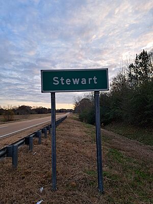
Stewart, Mississippi facts for kids
Quick facts for kids
Stewart, Mississippi
|
|
|---|---|
 |
|
| Country | United States |
| State | Mississippi |
| County | Montgomery |
| Area | |
| • Total | 1.13 sq mi (2.92 km2) |
| • Land | 1.13 sq mi (2.92 km2) |
| • Water | 0.00 sq mi (0.00 km2) |
| Elevation | 351 ft (107 m) |
| Population
(2020)
|
|
| • Total | 99 |
| • Density | 87.77/sq mi (33.90/km2) |
| Time zone | UTC-6 (Central (CST)) |
| • Summer (DST) | UTC-5 (CDT) |
| ZIP code |
39767
|
| Area code(s) | 662 |
| GNIS feature ID | 678280 |
| FIPS Code | 28-70640 |
Stewart is a small community in Montgomery County, Mississippi, in the United States. It's known as a census-designated place, which means it's a special area the government counts for population. Even though it's not a city or town with its own local government, it's still an important place. In 2020, about 99 people lived there. Stewart is also home to its own volunteer fire department, helping keep everyone safe.
Contents
Stewart's Story: A Look Back in Time
Stewart has an interesting past. In the late 1880s, the Georgia Pacific Railway built a train line right through the community. This was a big deal because railways helped connect places and move goods.
By 1906, Stewart had grown quite a bit. It had its own post office and a population of 200 people.
Later, in the 1950s, something special was found near Stewart: a lot of iron ore! This ore was dug up and sent by train all the way to Birmingham, Alabama. There, it was processed to make iron and steel.
Stewart was officially listed as a census-designated place for the first time in the 2020 census. This means it's now a recognized area for counting people.
Where is Stewart? Geography Facts
Stewart is located in the eastern part of Montgomery County. It shares a border with Webster County to the north.
A main road, U.S. Route 82, goes right through Stewart. If you travel west on this road for about 8 miles, you'll reach Kilmichael. If you go northeast for about 12 miles, you'll find Eupora. Winona, which is the main town of Montgomery County, is about 19 miles west on US 82.
The U.S. Census Bureau says that Stewart covers an area of about 1.13 square miles. All of this area is land. The Big Black River flows just south of the community.
Who Lives in Stewart? Population Details
| Historical population | |||
|---|---|---|---|
| Census | Pop. | %± | |
| 2020 | 99 | — | |
| U.S. Decennial Census 2020 |
|||
Learning about the people who live in a place is called demographics. The 2020 census counted 99 people living in Stewart.
Stewart's Population Mix in 2020
The census also looks at different groups of people. Here's a quick look at the population of Stewart in 2020:
| Group | Number of People (2020) | Percentage (2020) |
|---|---|---|
| White (not Hispanic) | 91 | 91.92% |
| Black or African American (not Hispanic) | 4 | 4.04% |
| Native American or Alaska Native (not Hispanic) | 1 | 1.01% |
| Asian (not Hispanic) | 0 | 0.00% |
| Pacific Islander (not Hispanic) | 0 | 0.00% |
| Some Other Race (not Hispanic) | 0 | 0.00% |
| Mixed Race/Multi-Racial (not Hispanic) | 3 | 3.03% |
| Hispanic or Latino (any race) | 0 | 0.00% |
| Total Population | 99 | 100.00% |
Note: The U.S. Census counts Hispanic/Latino as a separate group. People who are Hispanic/Latino can be of any race.
 | Lonnie Johnson |
 | Granville Woods |
 | Lewis Howard Latimer |
 | James West |


