Stob Coir' an Albannaich facts for kids
Quick facts for kids Stob Coir' an Albannaich |
|
|---|---|

Stob Coir' an Albannaich
|
|
| Highest point | |
| Elevation | 1,044 m (3,425 ft) |
| Prominence | 306 m (1,004 ft) |
| Listing | Munro, Marilyn |
| Geography | |
| Location | Argyll and Bute / Highland, Scotland |
| Parent range | Grampian Mountains |
| OS grid | NN169442 |
| Topo map | OS Landranger 50 |
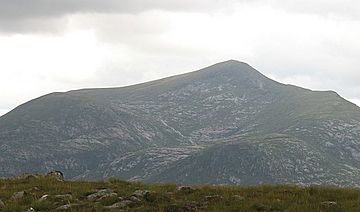
Stob Coir' an Albannaich is a tall mountain in Scotland. It stands at 1,044 meters (about 3,425 feet) high. This mountain is part of the Grampian Mountains, a large mountain range in the Scottish Highlands.
It sits right on the border between two areas: Argyll and Bute and the Highlands. You can find it south of a beautiful valley called Glen Etive.
What Makes Stob Coir' an Albannaich Special?
Stob Coir' an Albannaich is known for a few reasons. It is a "Munro" and also a "Marilyn."
Munros and Marilyns
- Munro: A Munro is a Scottish mountain that is over 3,000 feet (914.4 meters) high. There are 282 Munros in Scotland, and climbing them all is a popular challenge for hikers!
- Marilyn: A Marilyn is a hill or mountain in the British Isles that has a "prominence" of at least 150 meters (about 492 feet). Prominence means how much a mountain rises above the land around it. Stob Coir' an Albannaich rises 306 meters above its surroundings.
Exploring the Mountain
This mountain is a great place for a "traverse." A traverse means hiking along the ridge or across the top of a mountain, often going from one side to the other. It offers amazing views of the Scottish landscape.
The closest village to Stob Coir' an Albannaich is Taynuilt. It is located to the south of the mountain. Hikers often start their adventures from nearby villages like Taynuilt.
 | Janet Taylor Pickett |
 | Synthia Saint James |
 | Howardena Pindell |
 | Faith Ringgold |

